

Chauriat
Auvergne-Rhône-Alpes, Puy-de-Dôme
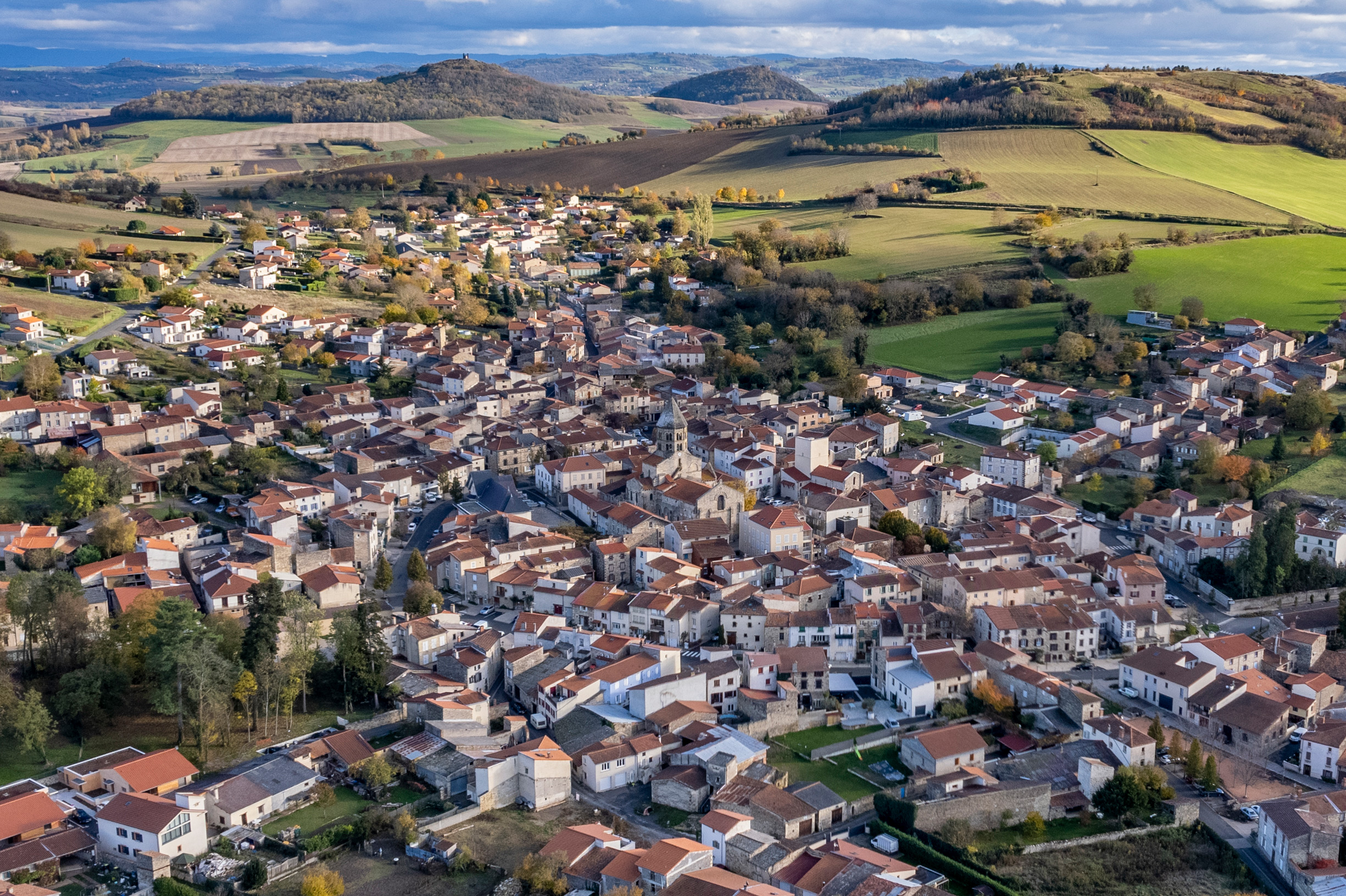
Chauriat, Petite Cité de Caractère®
Chauriat is designated Petite Cité de Caractère®. As such, it forms part of a national project aimed at promoting and protecting the architectural heritage of little towns across France. Through tourism, the initiative encourages visitors to embrace the local culture by strolling through the streets, learning about the history of the area, taking part in local events, and discovering the local way of life. In Puy-de-Dôme, there are several Petite Cité de Caractère® little towns to discover. The digital map will help you navigate each of them and highlight their main attractions.
Presentation
Old Priory Church of Saint-Julien
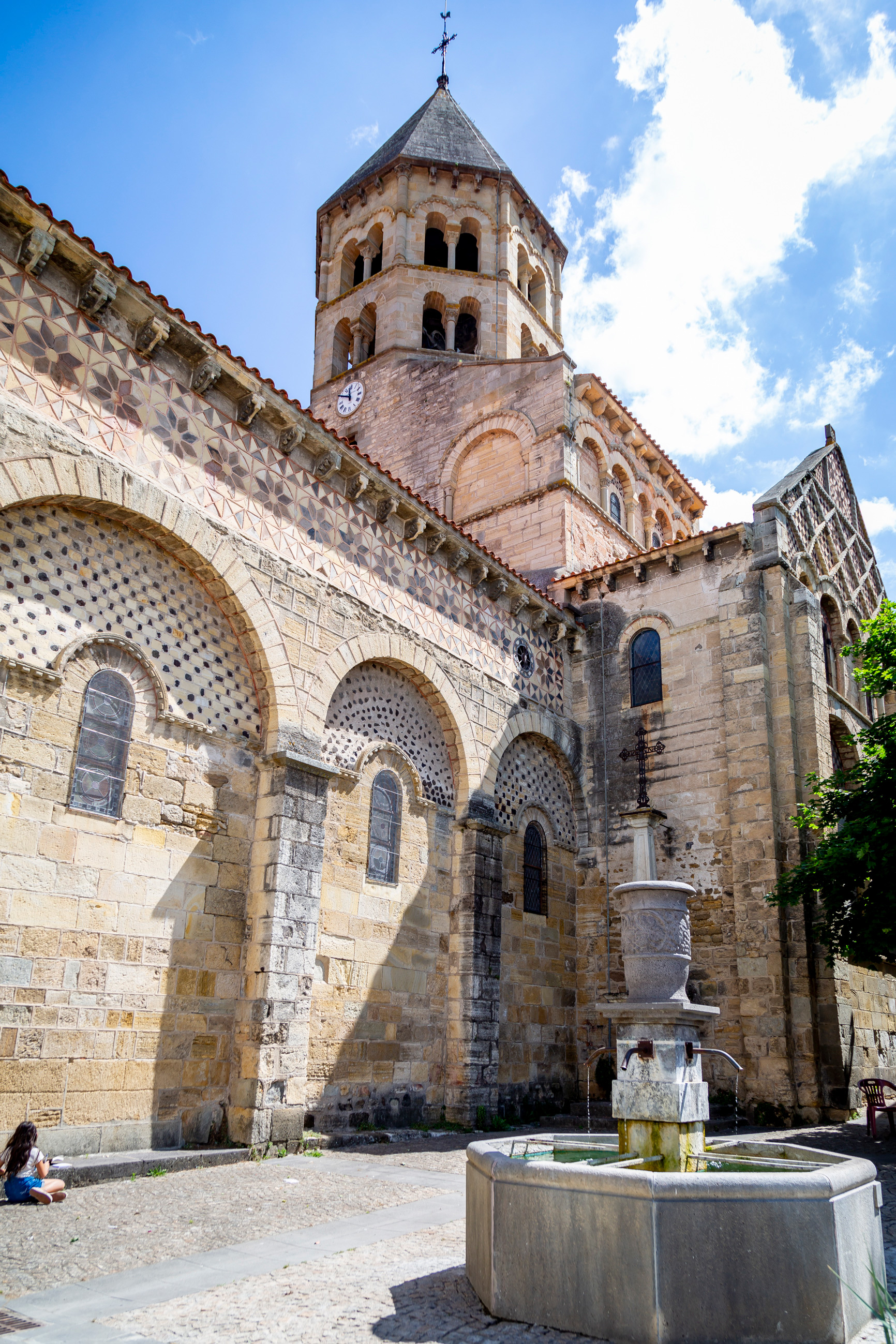
It was donated to the Cluniac Order in the 11th century, along with two other churches in Chauriat. Dedicated to Saint Julien, it was completed in 1095, albeit only with regard to the choir. Over time, climatic and human factors altered its appearance, stripping it of its radiating chapels and public galleries. Similar to the church of Saint-Nectaire, it shares the same layout and builders, as well as its octagonal bell tower. The latter was destroyed during the Revolution and rebuilt based on the design of Saint-Saturnin Church. Portions of the polychrome decoration on the south and west façades date back to a restoration carried out by the architect Aymon Gilbert Mallay in the mid-19th century. Specialising in the restoration of historic monuments in Auvergne, Mallay was responsible for restoring the Saint-Julien Church after it was included among the first historic monuments in 1840.
Sainte-Marie Church
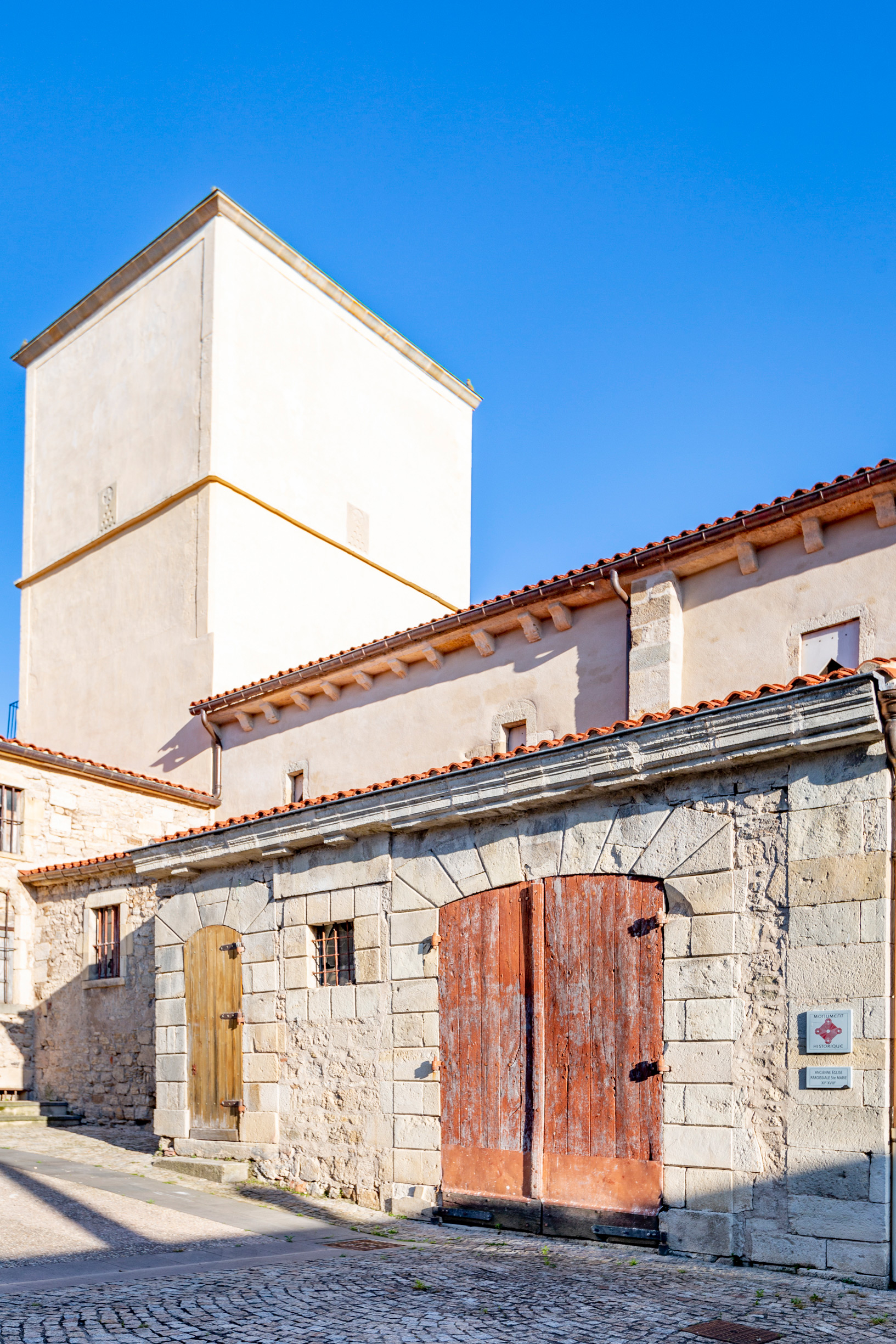
Built during the Carolingian period using reused Gallo-Roman materials, it was remodelled in the 12th century. During the French Revolution, it was sold to Claude-Antoine Rudel du Miral, who converted it into a barn, and later used as a wine cellar. Today, the 'Caves de l'Abbaye' (Abbey Cellars) occupy the building. The church is a Romanesque building that has retained some of its painted decorations and ancient columns, which are still visible today. The bell tower was later converted into a dovecote and decorated with carved pigeons and Masonic symbols, the order to which Rudel du Miral belonged. It houses the Rudel du Miral family's funeral chapel.
Village Fort
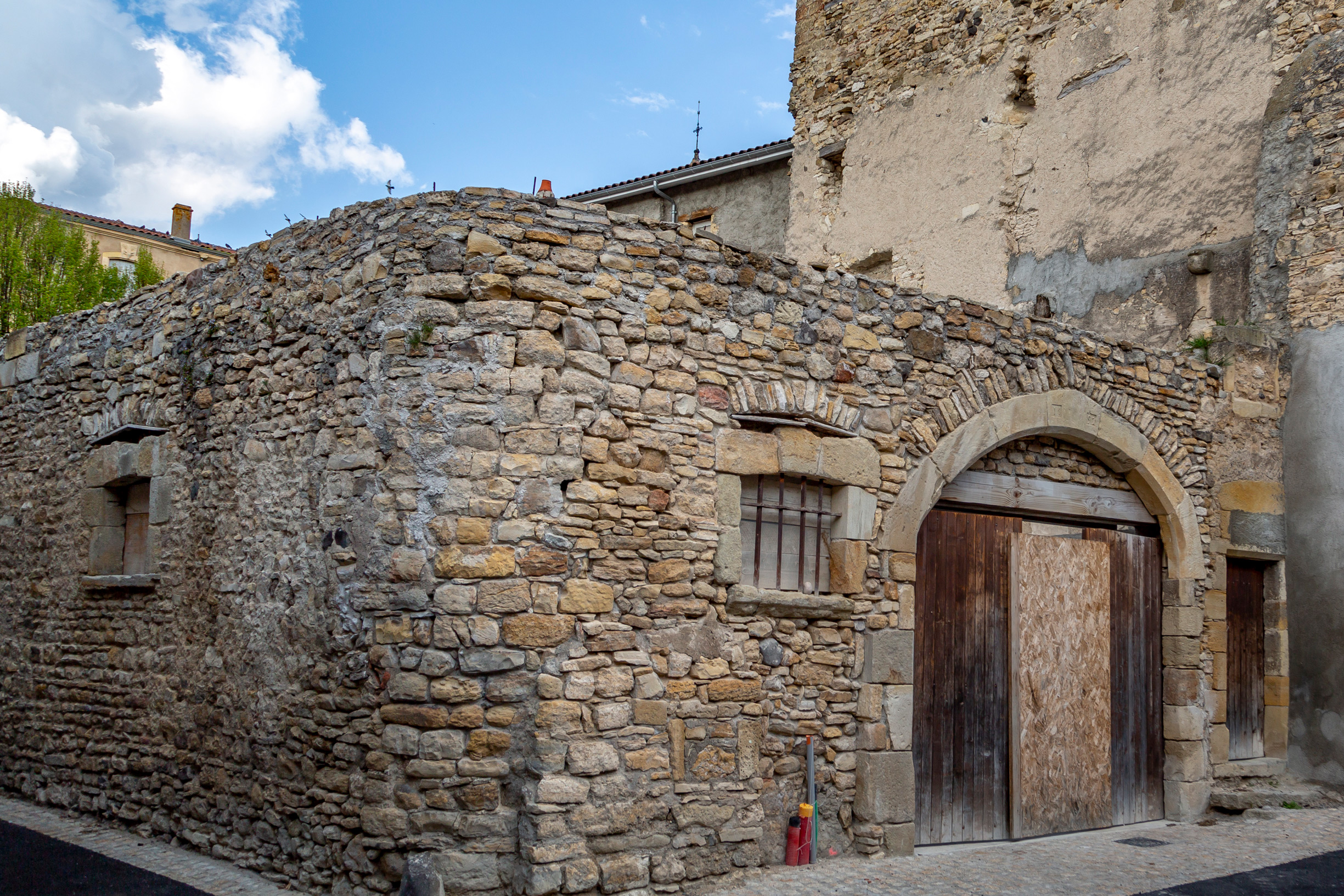
Built and enlarged between 1283 and 1452, the fort gradually lost in importance. A coat of arms from 1610, located on one of the houses on Rue de l'Abbaye next to the Church of Sainte-Marie, recalls the presence of an ancient tower. Further along Rue des Vignerons, a 15^(th)-century tower that was later converted into a dovecote still stands. The fort's maximum extent corresponds to the boulevard that forms the ring road. The four gates of the fort, intact until 1786 and then sold, can be seen today on Rue des Cuviers and Rue de Voilhat.
The evolution of the defenses
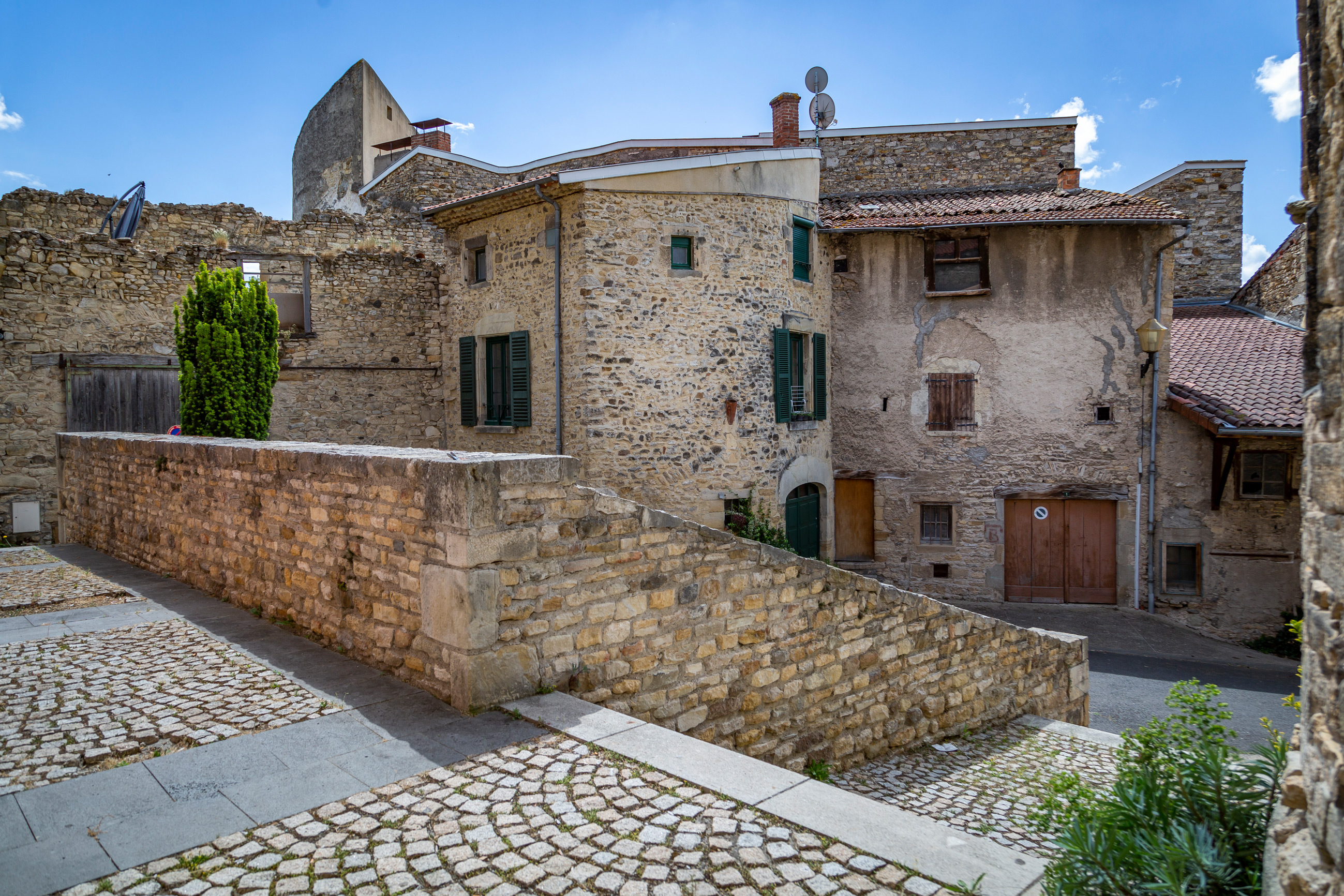
The first defenses date back to the 13th century: the existance of a moat was documented in 1283. The moat was stocked with fish, and the inhabitants had the right to use this resource. As the population grew, the fort was enlarged in successive stages between 1396 and 1452 to surround the churches. At the end of the 18th century, the fort's walls were destroyed to improve ventilation in the event of epidemics, and its stones were reused in the construction of houses.
Winegrowers' Houses
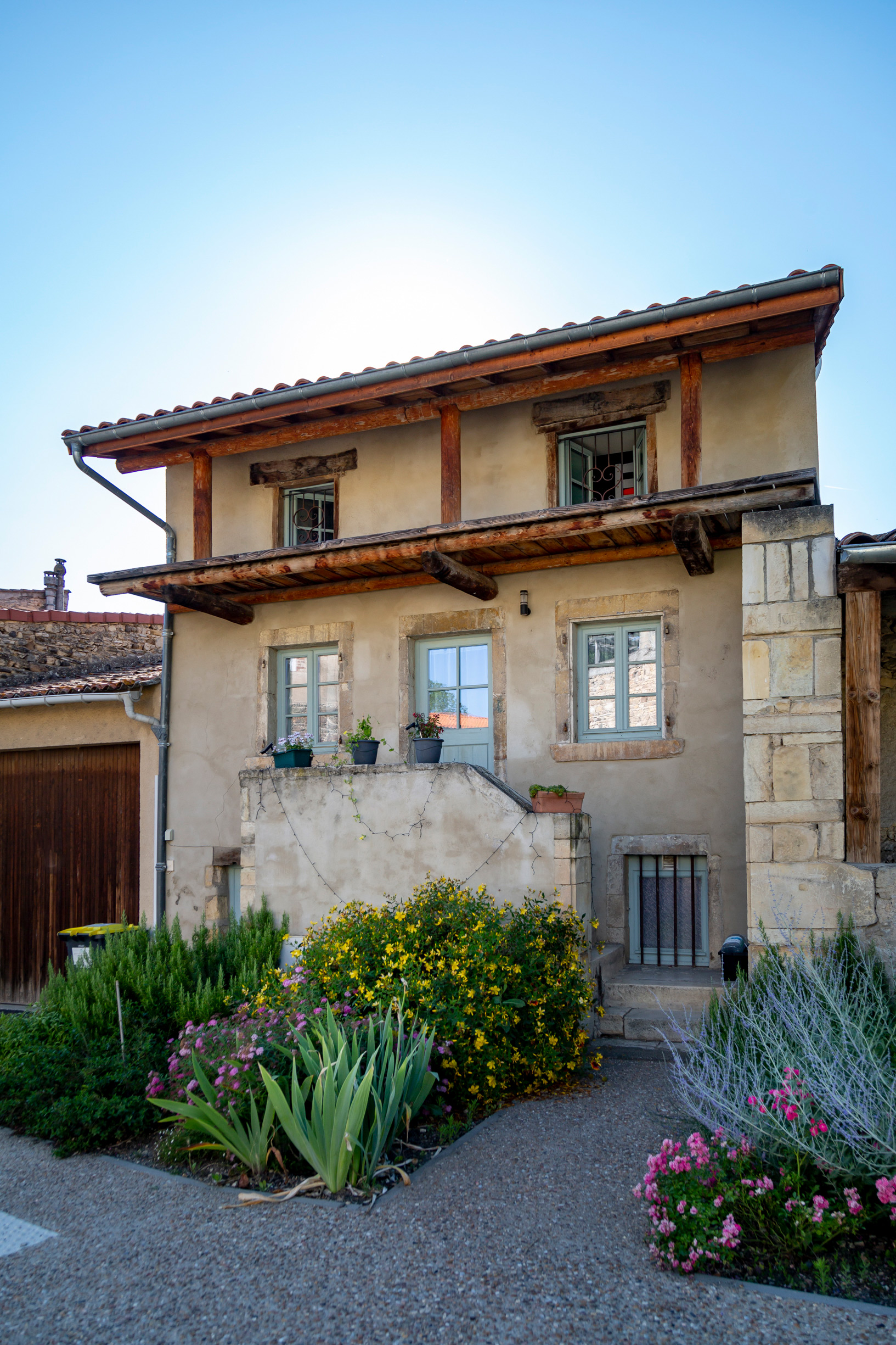
The surge in agricultural activity had a positive impact on Chauriat. The winegrowers' houses are recognisable by their external staircases, which lead to the first floor (the living area), and their covered galleries, known as estre, which run along the attic floor. These buildings combine cellars and wineries with living quarters.
Fountain
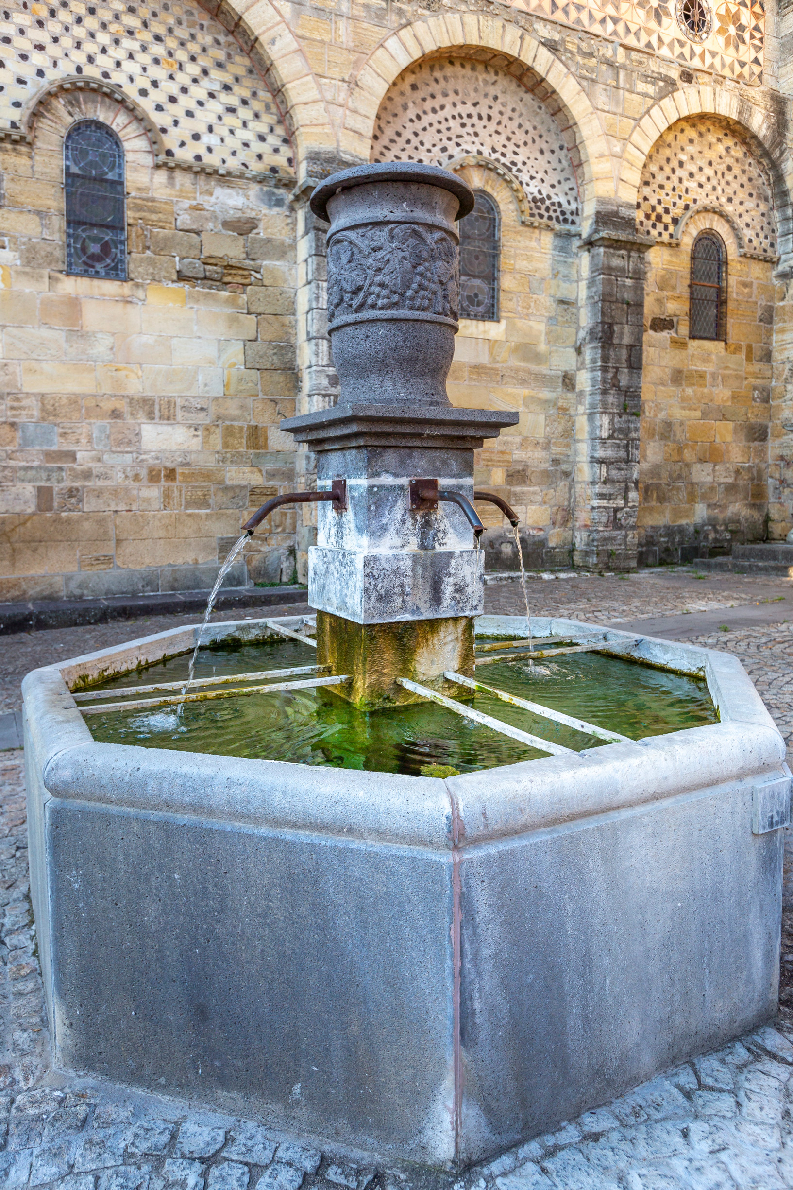
The fountain, which was previously located in the centre of the square, is now next to the church. It is characterised by its octagonal Volvic stone basin with a square base and a drain on each side. On top of the column sits a vase adorned with grapes and vine leaves, a nod to the area's wine-making heritage. Sculptor Jean Chauchard rebuilt it identically from old photographs.
Grain Exchange
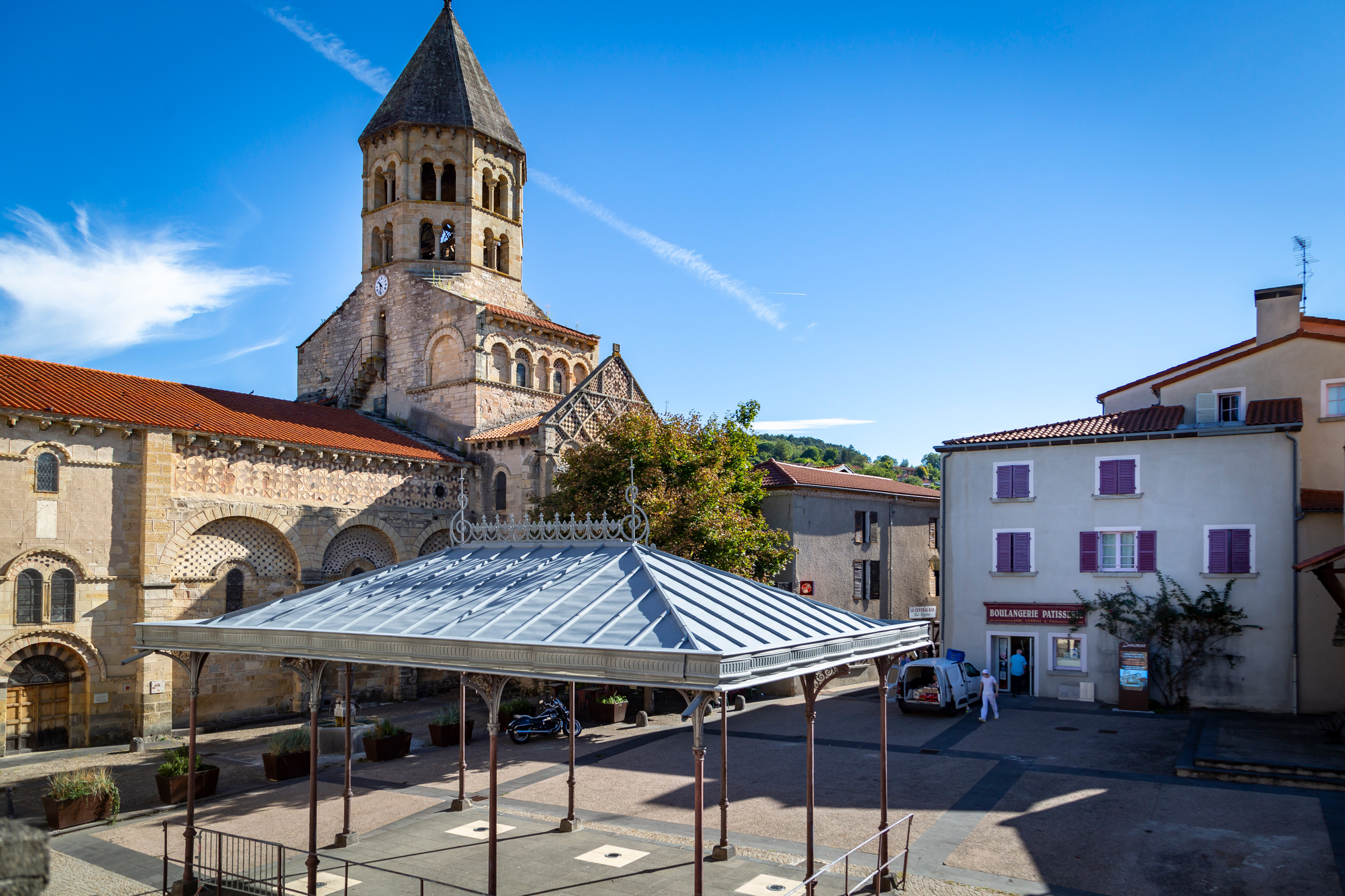
Located on the site of a disused cemetery, the building was designed by the architect Emile Louis Dalbine and constructed in 1889 by Cassoret Foundries in Arras, who specialised in bandstands. Rather than being decorated with representations of tools used in working with grains, the corn exchange features decorations that resemble treble clefs. It is one of only two surviving examples of exchanges built from metal in the second half of the 19th century in the department, the other is located in the village of Plauzat.
Michelin Milestone
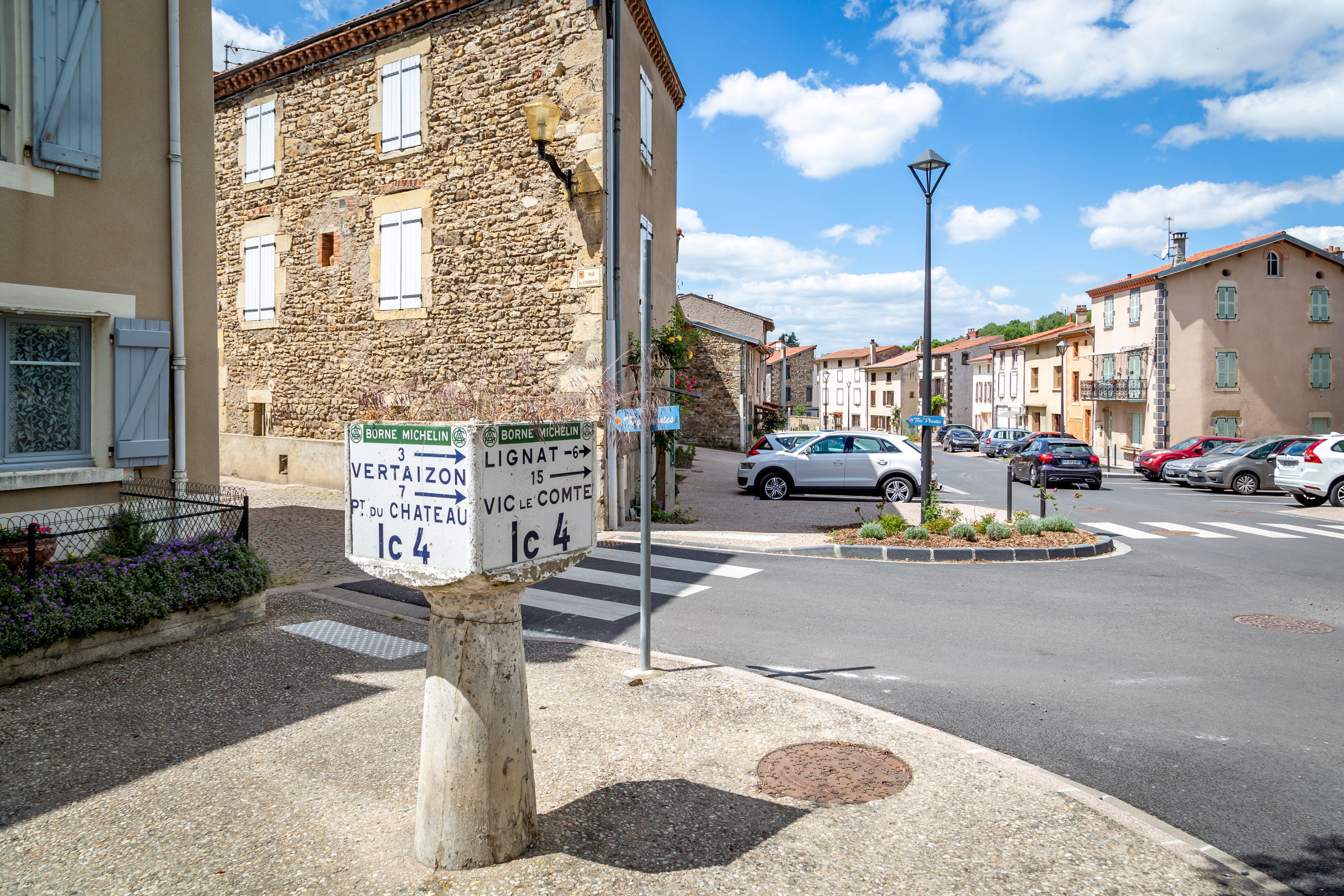
This type of marker has been used at major crossroads since the early 20th century. André Michelin campaigned for road numbering from 1912 onwards to make road navigation easier using simple, effective, and durable signage. From the end of the First World War until the 1970s, the plates were made of enamelled lava, while their supports were made of reinforced concrete.
The Deslandres House
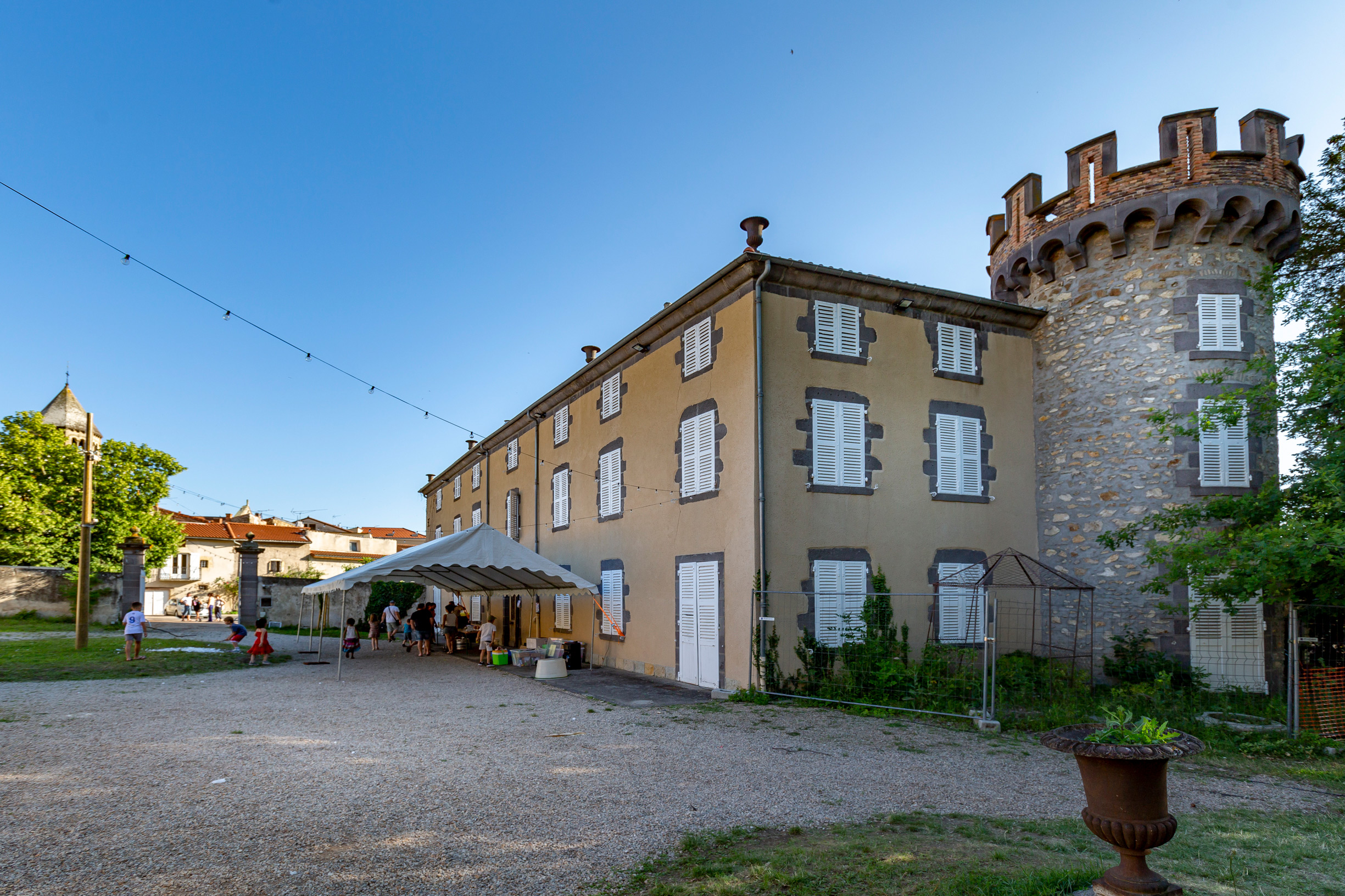
Built in the Baroque style in the 18th century (with a Medici vase ornament on the ridge), it was restored in the Neo-Gothic style in the 19th century (with the addition of the tower). Originally owned by Captain Louis Desmales, an officer of the First French Empire, ownership was eventually passed down to Léon Deslandres, Inspector General of Water and Forests, who planted the trees in the park.
Rudel du Miral Mansion
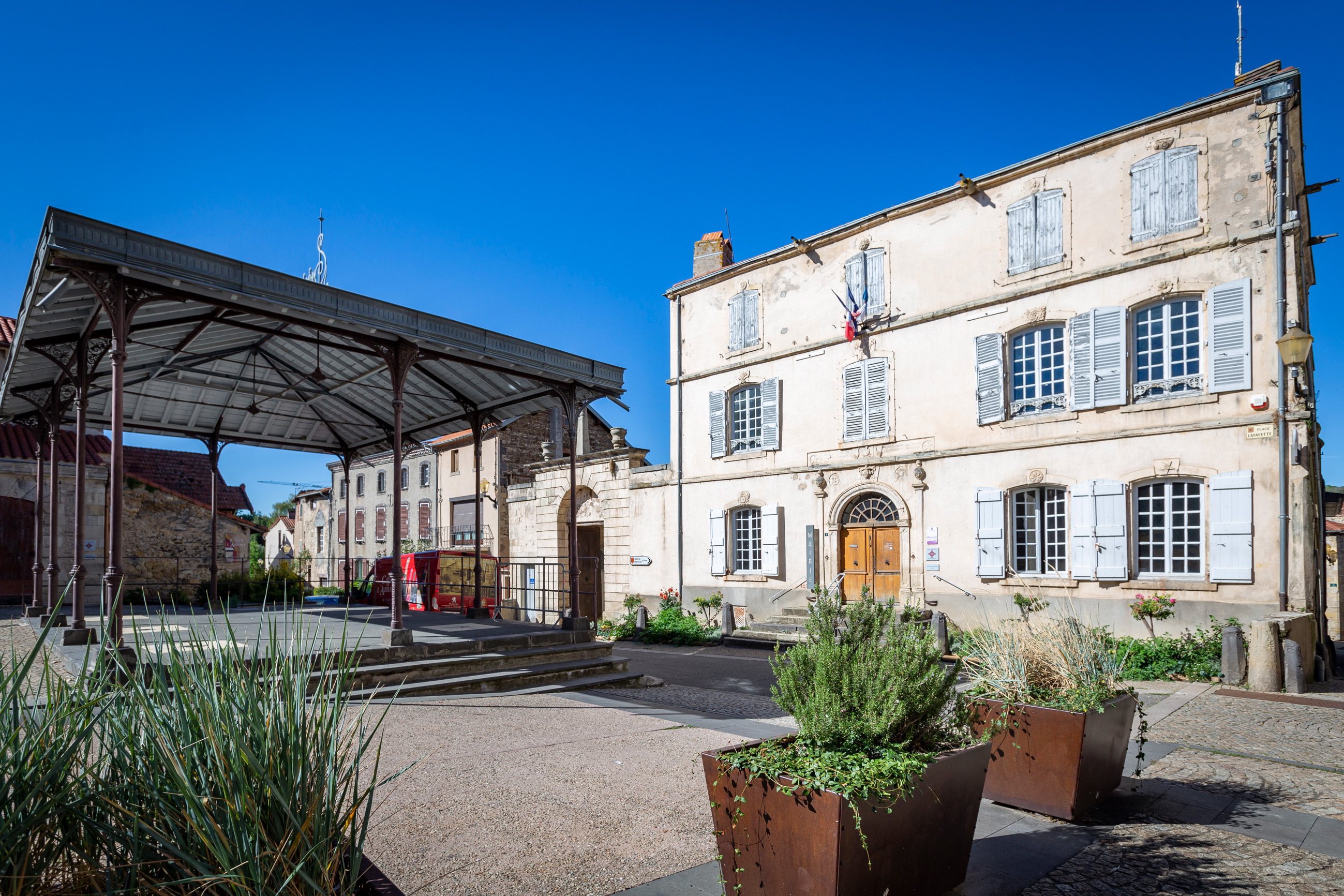
This former private residence, now the town hall, was built by Claude-Antoine Rudel du Miral at the end of the 18th century. It is decorated with painted and sculpted motifs combining Masonic symbols, including an ouroboros symbolising the closed cycle and chaos, and the moon and sun, representing femininity and masculinity or positivity and negativity. Rudel belonged to the local nobility. Born in Chauriat, he married a young woman from Miral and he studied law and became a lawyer at the Parliament of Paris, later serving three times as mayor of Thiers. He embraced revolutionary ideas and in 1792 was elected representative for Puy-de-Dôme. As dean of the National Convention, he voted in favour of Louis XVI's execution and opposed Robespierre and the Reign of Terror. He also played a key role in the 19th-century rediscovery of the works of Olivier de Serres, the father of agriculture.
The People's House
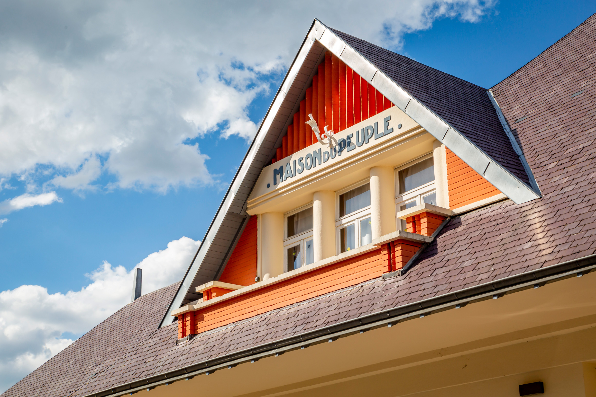
The mayor at the time, Jean-Baptiste Farnoux, commissioned the architect Antoine Fustier to design a house for the people. It was inaugurated in 1938 with great pomp and circumstance in the presence of Marx Dormoy, a French socialist politician who was also Minister of the Interior during the Popular Front. Built in the modern regionalist style widely used for Popular Front-era buildings, it features gables and murals celebrating Liberty and Labour. The interior décor has been preserved. The Maison du Peuple served as a meeting place for the working class, but also as a town hall, public toilets and public baths.
Ralph Stackpole
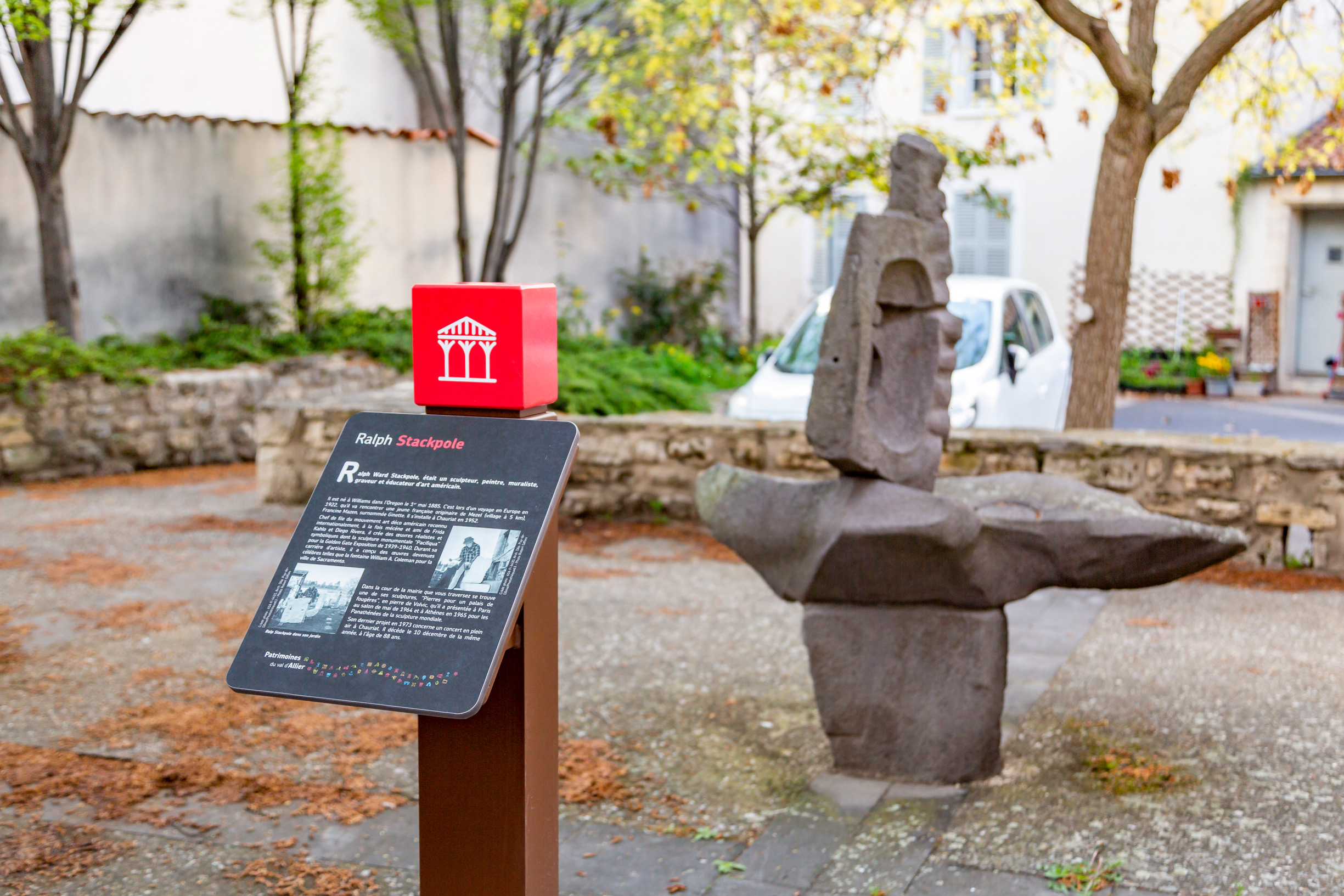
Born in the United States in 1885, Stackpole was the leader of the 'American Art Deco' movement. He was a sculptor, painter, muralist, engraver and art educator, as well as a friend and patron of Frida Kahlo and Diego Rivera. His best-known work is Pacifica, created for the Golden Gate Exposition of 1939–1940. He moved to Chauriat in 1952. In 1964, he sculpted ‘Pierres pour un Palais de Fougères’ (Stones for a Palace of Ferns) from Volvic stone for a Paris exhibit, and it was subsequently shown in Athens during the "Panathenaea" of World Sculpture in 1965. Over time, his works became less figurative and more abstract. In 1961, he became a member of the Fédération Française des Sociétés d'Art. In 1964, the San Francisco Art Institute recognised his outstanding contribution to the excellence of the visual arts. Between 1965 and 1972, he was a member of the jury for the Prix des Volcans in Clermont-Ferrand. His final major project, in 1973, was an open-air concert in Chauriat. He passed away the same year, aged 88.

Ce projet de carte interactive est porté par les associations Petites Cités de Caractère® de France, Petites Cités de Caractère® en Auvergne Rhône Alpes, Petites Cités de Caractère® du Puy-de-Dôme et par la commune de Chauriat.
Il est soutenu financièrement par la convention FNADT du Commissariat Massif Central, par l'appel à projet « patrimoine et numérique » de la Région Auvergne Rhône- Alpes, et par la Fondation d’Entreprises du Crédit Agricole Centre France.
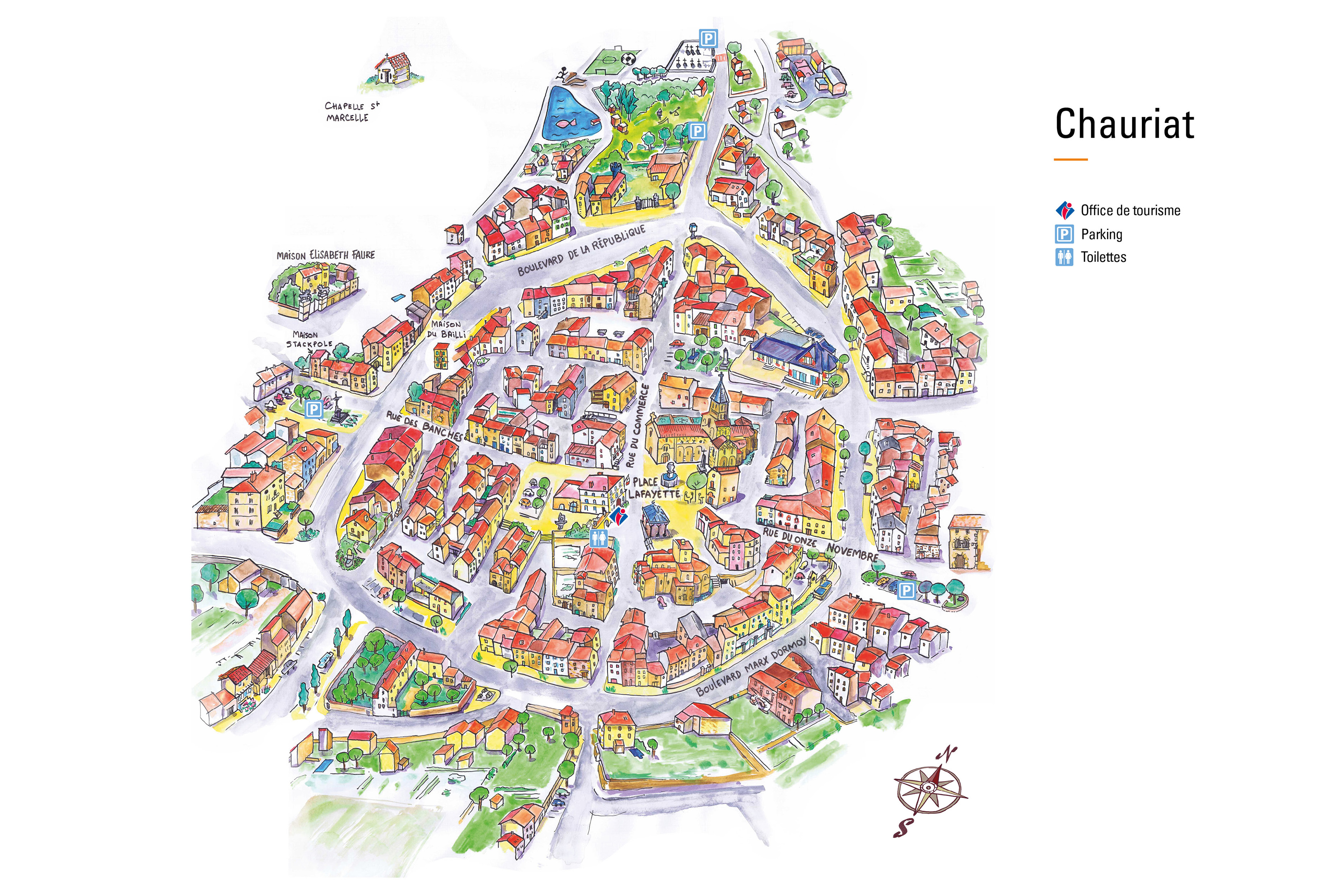
Le plan de la commune (visuel de fond) a été réalisé par Lemoineau.
Les traductions en anglais ont été réalisées par Kim Spychalski.
Les voix ont été produites et enregistrées par Nathalie Moniot (version française), Tamara Souverain (version anglaise).
Les photos ont été produites et réalisées par Julie Baudin. Les photographies réalisées par Julie Baudin ont été subventionnées par le Conseil départemental du Puy-de-Dôme.
Les vidéos ont été produites et réalisées par Petites Cités de Caractère®.
Conception et développement de la carte interactive par Tabula Rasa.


Ce projet de carte interactive est porté par les associations Petites Cités de Caractère® de France, Petites Cités de Caractère® en Auvergne Rhône Alpes, Petites Cités de Caractère® du Puy-de-Dôme et par la commune de Chauriat.
Il est soutenu financièrement par la convention FNADT du Commissariat Massif Central, par l'appel à projet « patrimoine et numérique » de la Région Auvergne Rhône- Alpes, et par la Fondation d’Entreprises du Crédit Agricole Centre France.
Le plan de la commune (visuel de fond) a été réalisé par Lemoineau.
Les traductions en anglais ont été réalisées par Kim Spychalski.
Les voix ont été produites et enregistrées par Nathalie Moniot (version française), Tamara Souverain (version anglaise).
Les photos ont été produites et réalisées par Julie Baudin. Les photographies réalisées par Julie Baudin ont été subventionnées par le Conseil départemental du Puy-de-Dôme.
Les vidéos ont été produites et réalisées par Petites Cités de Caractère®.
Conception et développement de la carte interactive par Tabula Rasa.