

Châteldon
Auvergne-Rhône-Alpes, Puy-de-Dôme
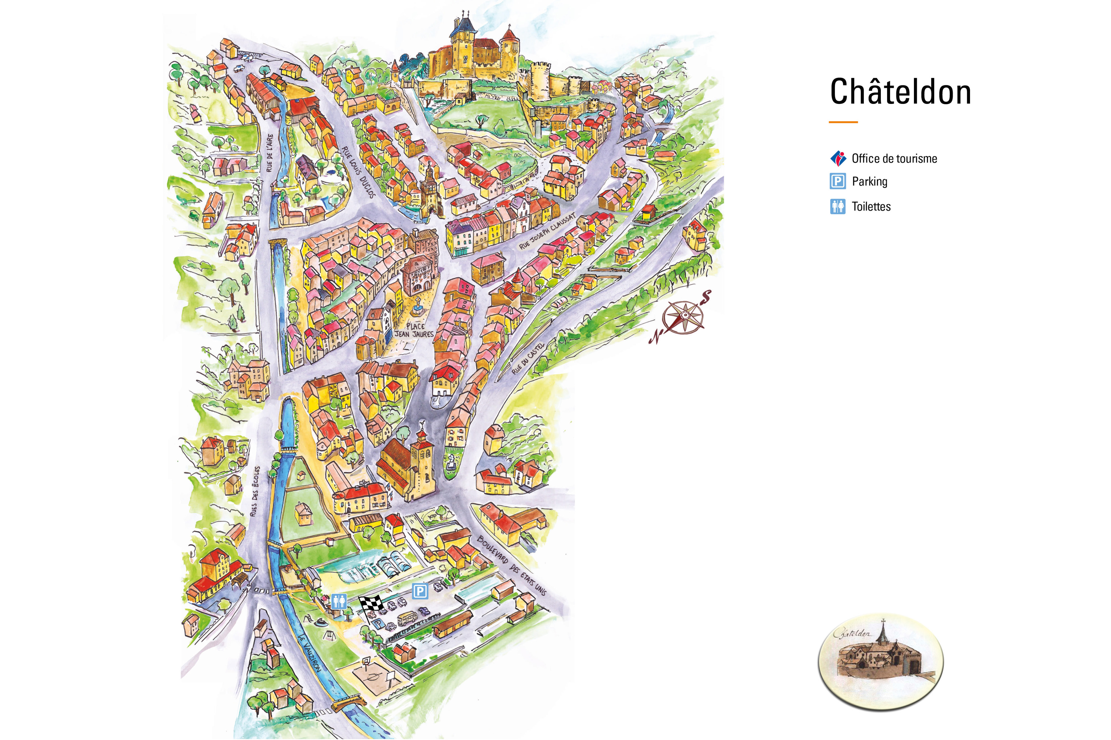
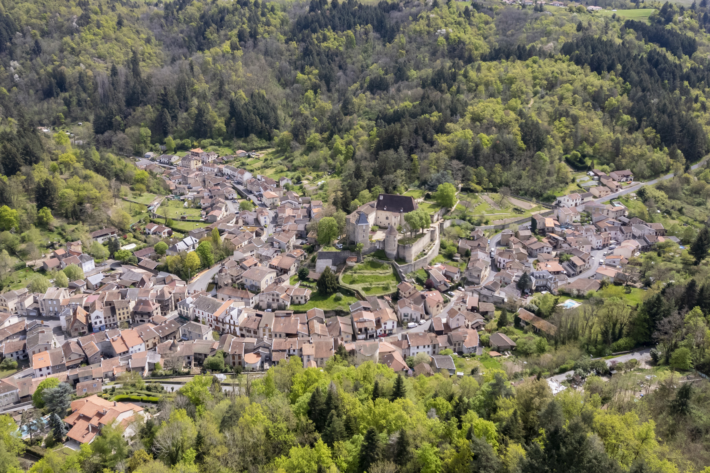
Châteldon, Petite Cité de Caractère®
Châteldon is designated Petite Cité de Caractère®. As such, it forms part of a national project aimed at promoting and protecting the architectural heritage of little towns across France. Through tourism, the initiative encourages visitors to embrace the local culture by strolling through the streets, learning about the history of the area, taking part in local events, and discovering the local way of life. In Puy-de-Dôme, there are several Petite Cité de Caractère® little towns to discover. The digital map will help you navigate each of them and highlight their main attractions.
Presentation
The Vauziron and its banks
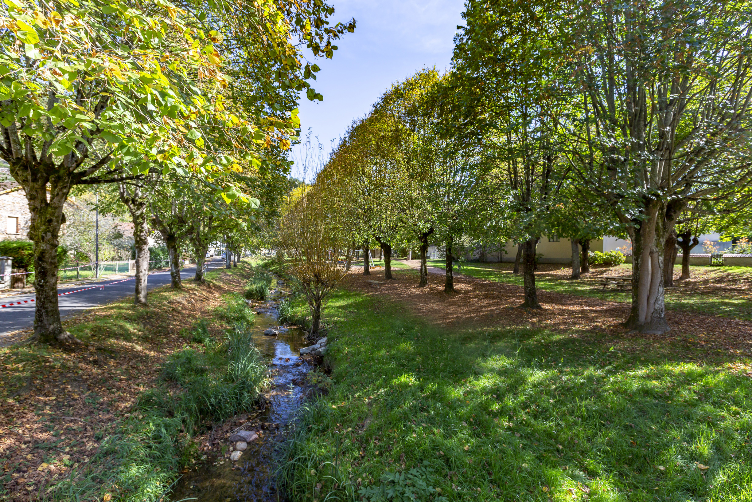
The river has its source at Rez-de-Sol, a geological curiosity consisting of a quartz vein, and flows into the Dore River, a tributary of the Allier River. Downstream, the banks of the Vauziron have been turned into a footpath.
The fortifications and their towers
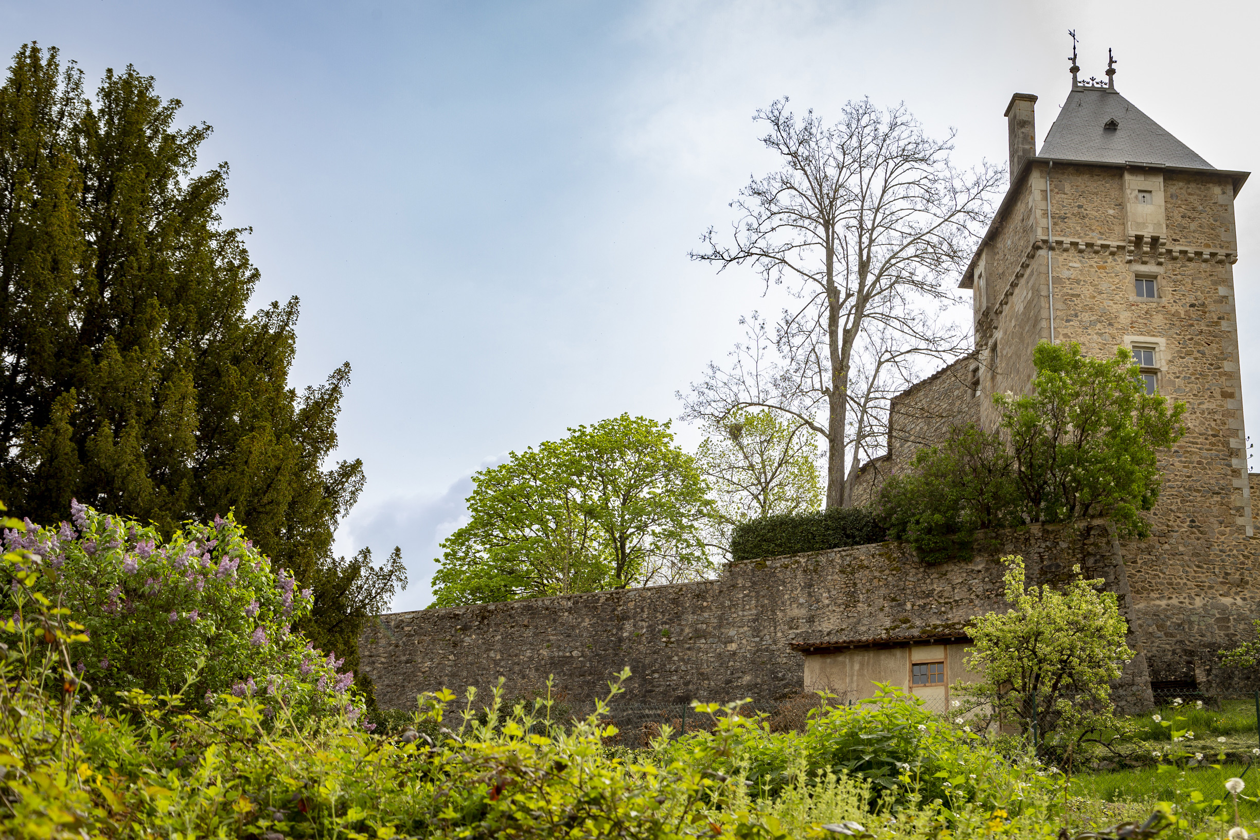
At the end of the 13th century, the enclosure only protected the castle and its outbuildings, such as the stables, wine press, and barnyard. The second enclosure and its fortifications, which were built in the following century, included numerous towers, massive granite structures equipped with arrow slits and connected to each other by the old fortification. Several towers and sections of the surrounding wall remain today, housing buildings including the town hall.
The Pont des Dames (Couvent des Clarisses)
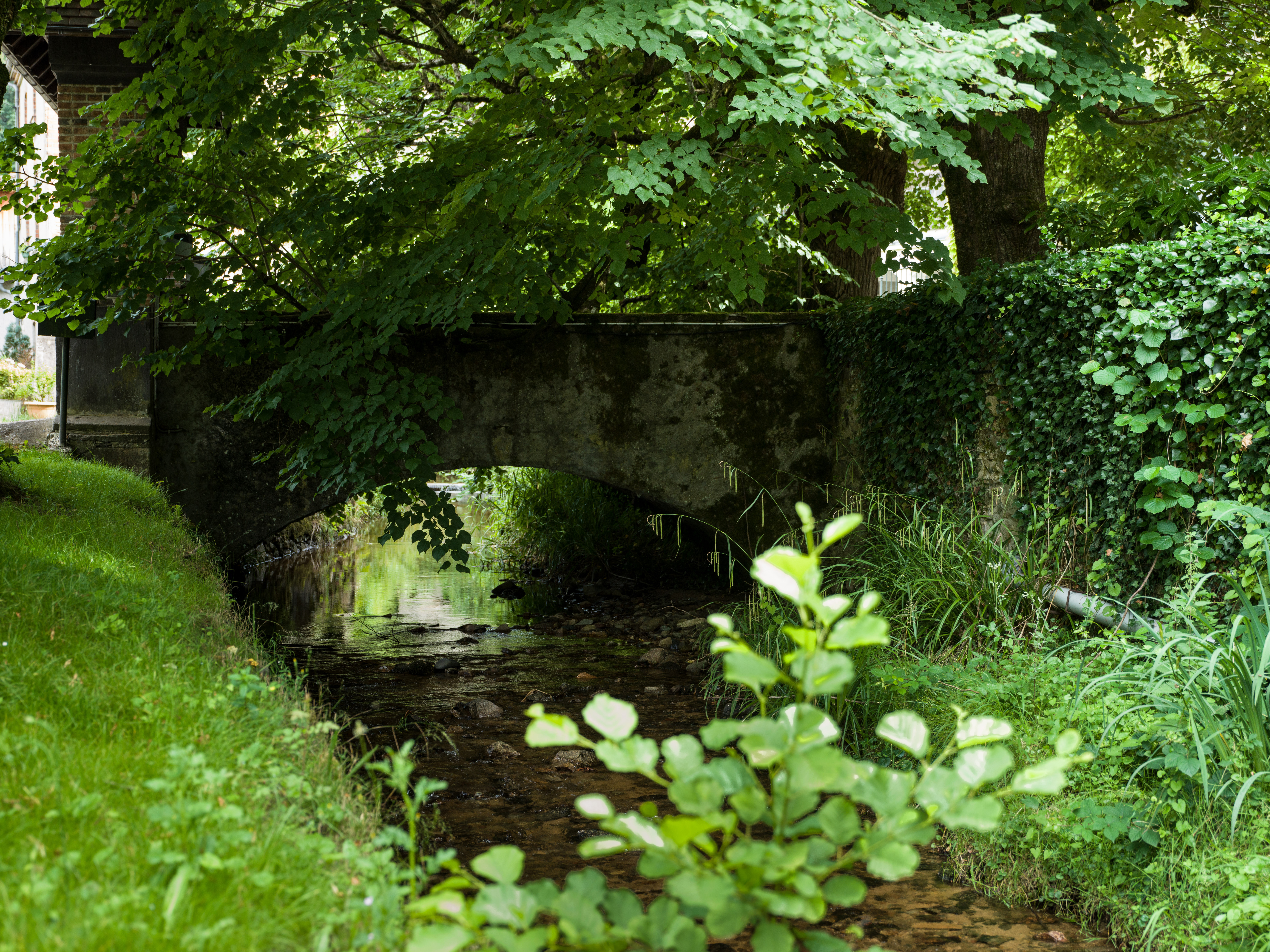
Built in 1650, it enabled the nuns to cross the Vauziron. Only the name of the bridge attests to the presence of the nuns in Châteldon. The convent, confirmed by Louis XIV in 1667, consisted of a courtyard, parlour, cloister, chapel and sacristy. It was occupied for over a century before being abandoned due to a decline in income. It was sold during the Revolution in 1791.
Old Cordeliers Convent
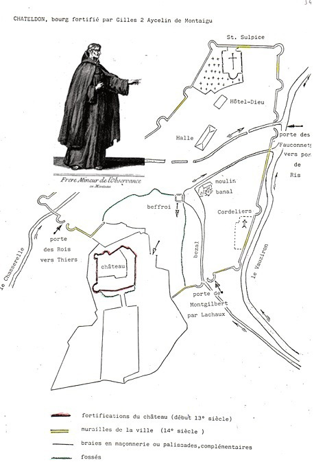
Founded in 1463 by Philippe de Vienne, Lord of Châteldon, the convent followed the Rule of Saint Francis and was part of the Observance order. The site consisted of a church, a refectory, outbuildings, a kitchen, a dormitory, a cloister and a chapter house. During the French Revolution, the church was looted and destroyed, leaving only the effigies of the founders. In 1791, the convent was sold and was demolished in 1861, the stones were reused to build new houses.
The Winegrowers' Houses
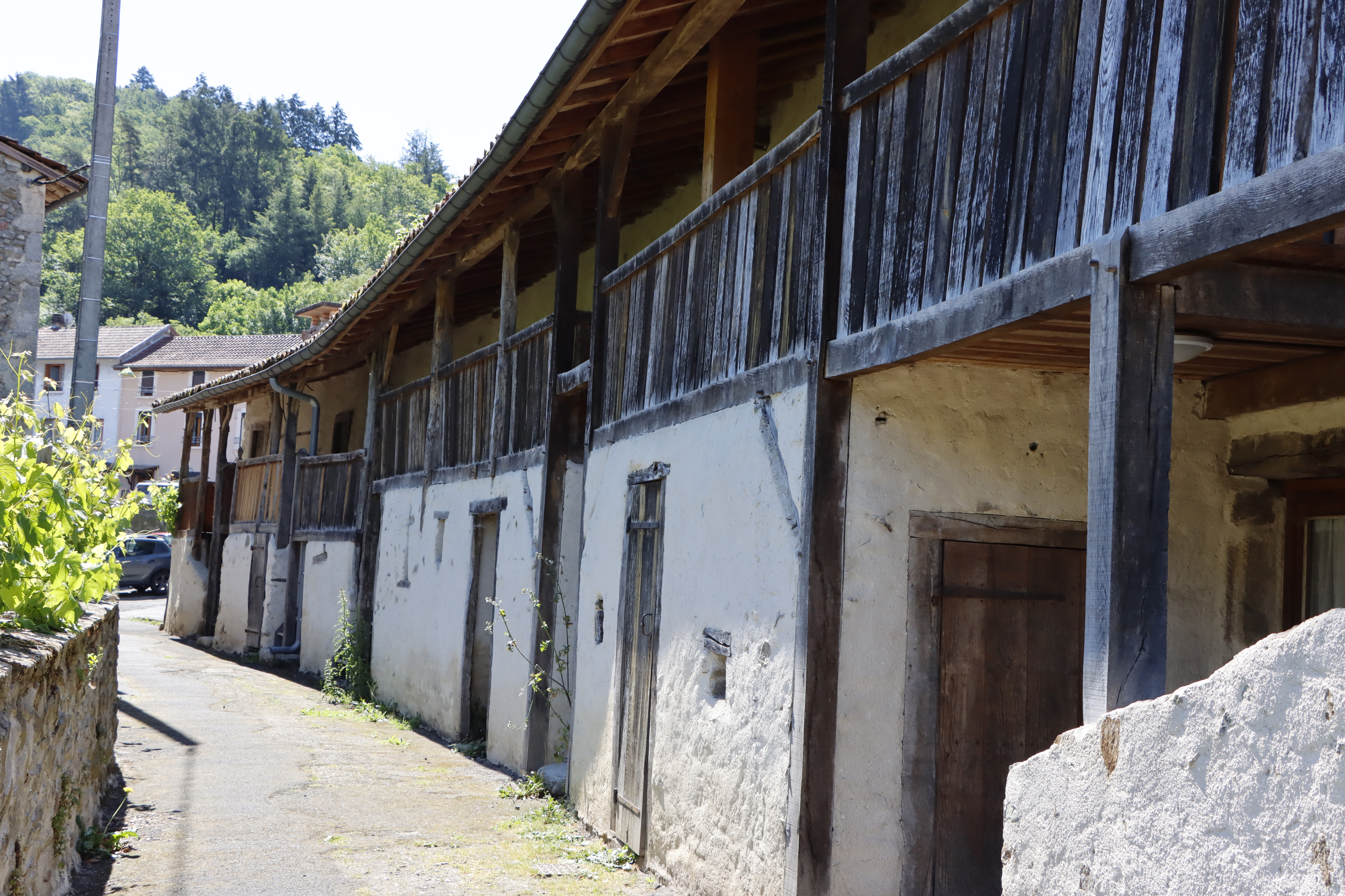
The 17th century saw vine cultivation develop on the hillsides and wine became Châteldon's main industry. The timber framed winegrowers' houses, built in rammed earth in the 17th century, are a testament to the town's wine-growing past. The houses are recognisable by their external staircases leading to a covered gallery. The ground floor housed winemaking facilities. The living quarters are located on the first floor, while the attic is used to store the grape harvest. Today, these houses have been converted into charming holiday cottages.
Mineral Water Spring
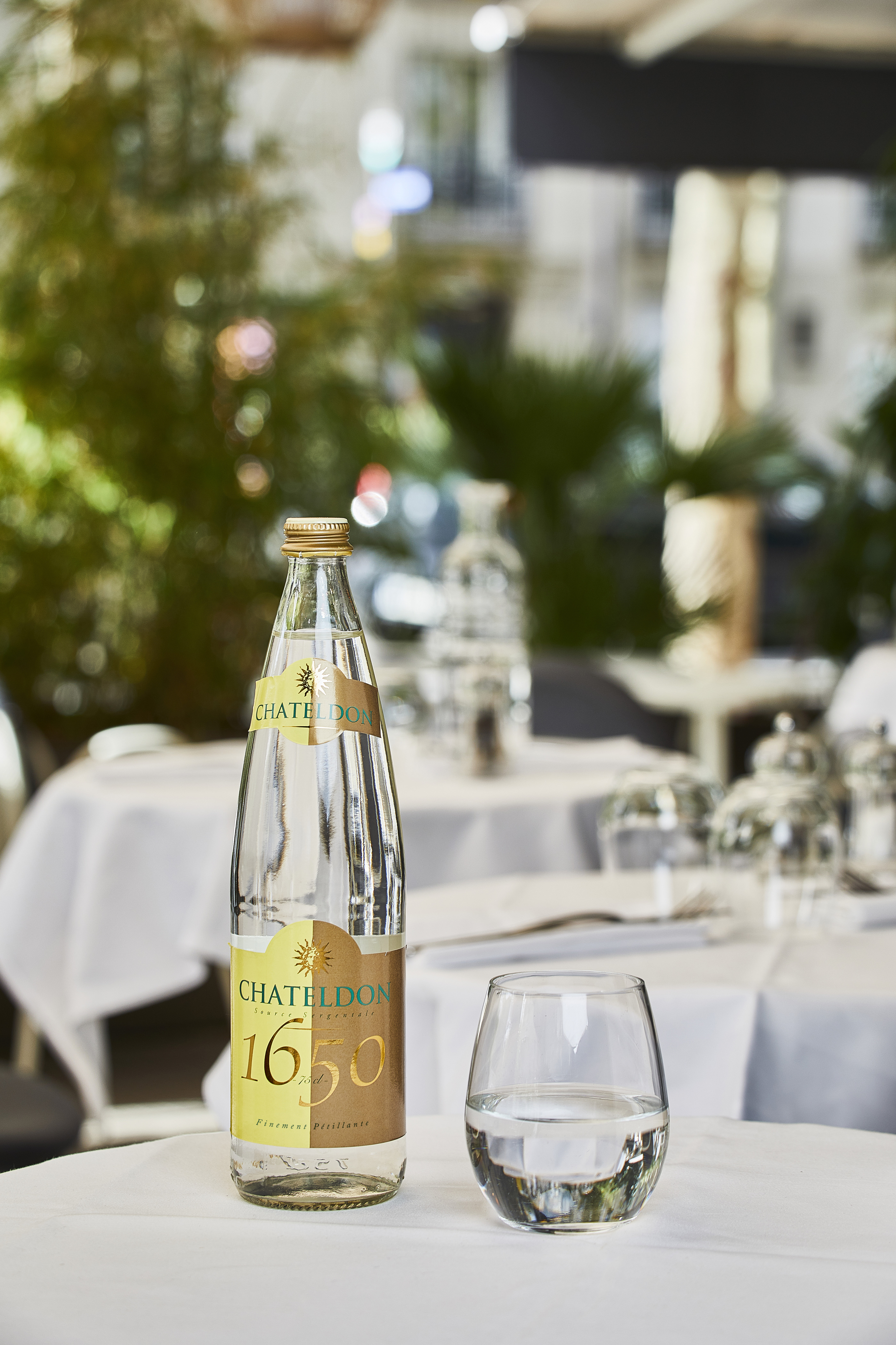
Dr Fagon, Louis XIV's physician, reportedly prescribed the water to alleviate the king's digestive problems. Louis XIV reportedly enjoyed it and had it delivered to Versailles. In 1778, a book was published detailing its beneficial properties. It became the first spring water to be extracted in France, then followed its commercialisation and the opening of a spa. However, the development of spas in Vichy led ultimately to the decline of Châteldon. Today, Châteldon water is served in the finest restaurants, sold in fine specialty grocery stores, and available in the town's shops.
Belfry
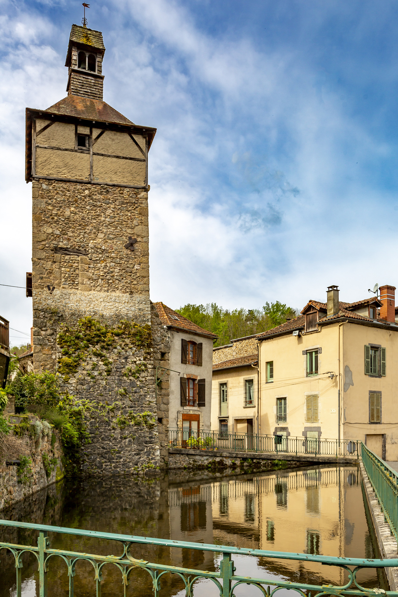
The belfry served as the gateway to the first defensive wall, probably from the end of the thirteenth century onwards. Three of its buttresses in Rue des Éperons are still visible today. Originally, it was a simple square tower. The semi-circular door, made of volcanic rock, opens onto the lower courtyard of the castle. In the 18th century, the tower was transformed into a monumental clock. During its restoration in the 20th century, timber framing, a bell tower with a lantern, and granite rubble masonry were added. The square openings in the framework are remnants of its connecting walkway.
Castle
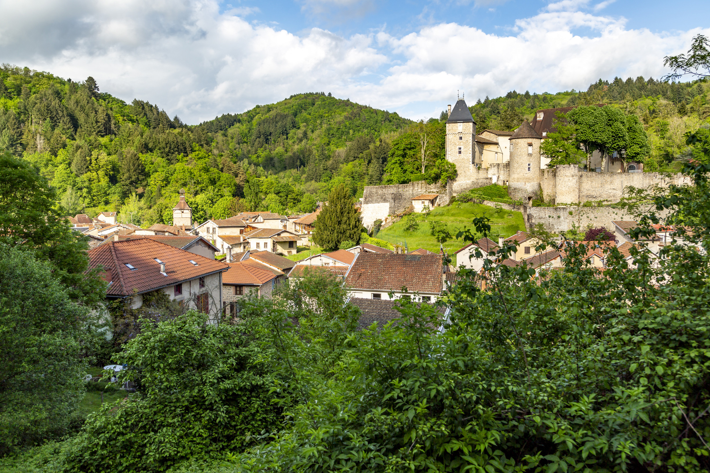
Strategically located between the Bourbonnais, Auvergne and Forez regions, the castle was built on a site that has been in use since the 12th century. The current building dates from the 13th century and has undergone numerous modifications, particularly in the 15th and 16th centuries, when the enclosure was built, reaching a height of 18 metres. The castle was heavily damaged in the 18th century by André Hébert, who destroyed the attic and used the stones to rebuild his estate at La Motte.
Viewpoint
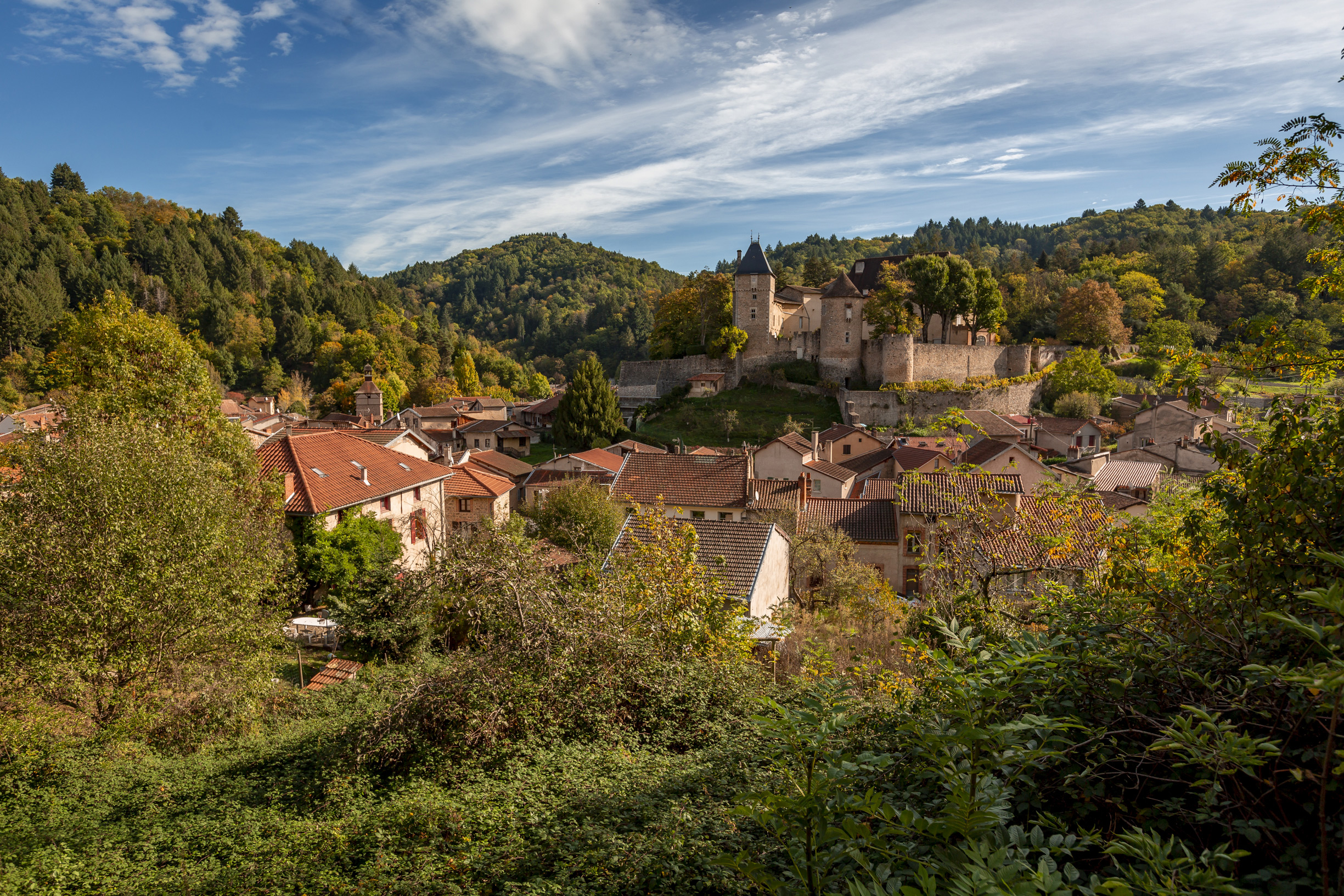
The viewpoint overlooks the village and the castle. The castle has been remodelled several times. At the entrance, you can see the north wing, the oldest part of the castle, which was once protected by a moat. The sloping meadow below, nicknamed ‘the English cemetery’, is said to have been used as a burial ground for Anglo-Burgundian looters who died in an assault in 1433 during the Hundred Years' War. Among the round towers still visible, several date back to the second enclosure, which was built from the 15^(th) century onwards and largely demolished over time.
Bust of Joseph Claussat
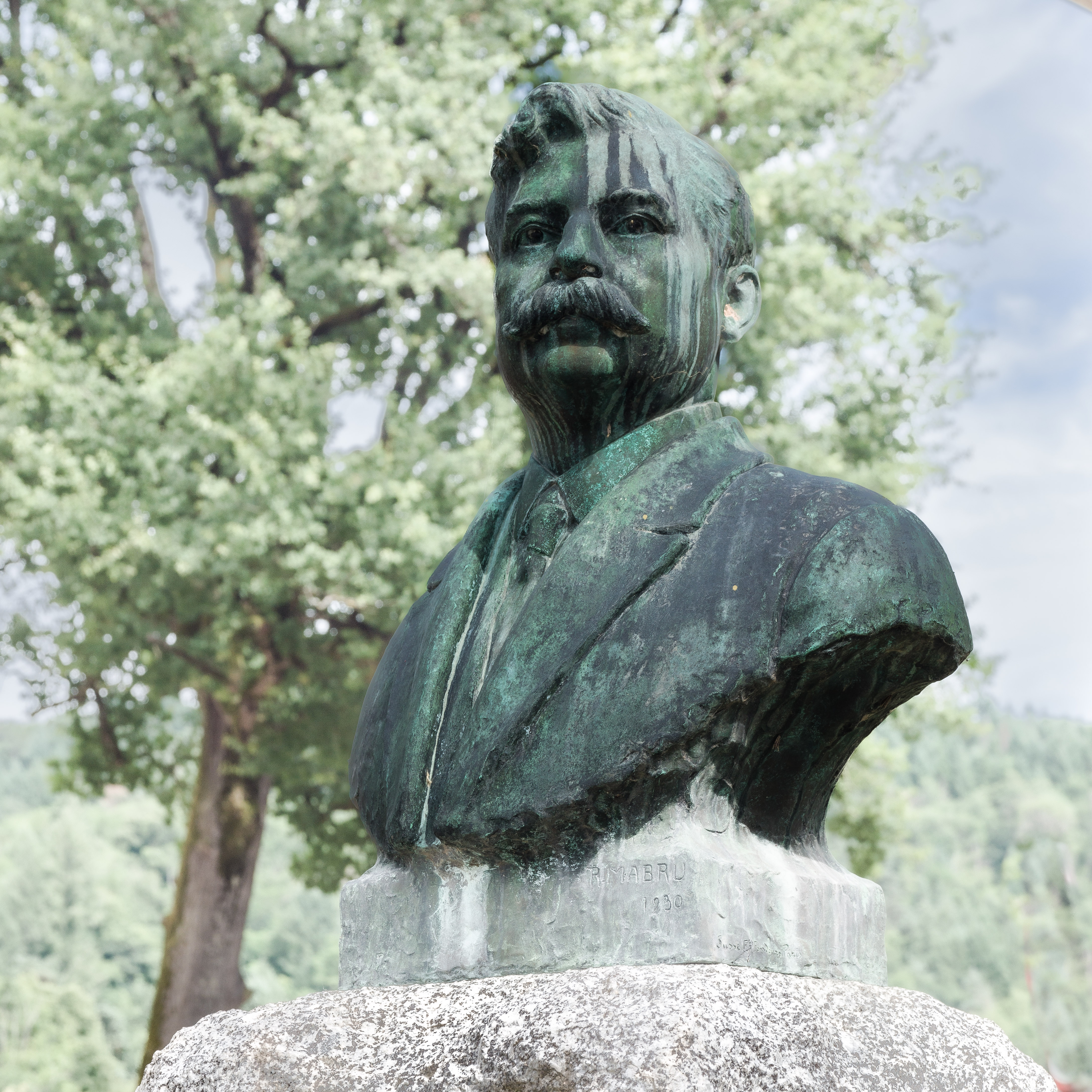
A socialist Member of Parliament and Mayor of Châteldon, Claussat styled himself as the candidate of the poor. Born in 1874, he qualified as a doctor in 1899 and was elected Mayor of Châteldon in 1908. He served in this role until his death at the age of 51 in 1925. In 1911, he became a member of the French Parliament for the Puy-de-Dôme district, sitting on the Agriculture Committee as well as the Hygiene and Markets Committee. He was re-elected three times, gaining national notoriety in the process. In his final speech, he quoted Montesquieu: “For a democratic republic to survive, it must be virtuous.” The bust is the work of sculptor Raoul Mabrut and the unvailing in July 1931 was attended by Léon Blum and Alexandre Varenne, the founder of the regional newspaper La Montagne, as well as several other dignitaries from the Socialist Party and 5,000 members of the public.
Effigies
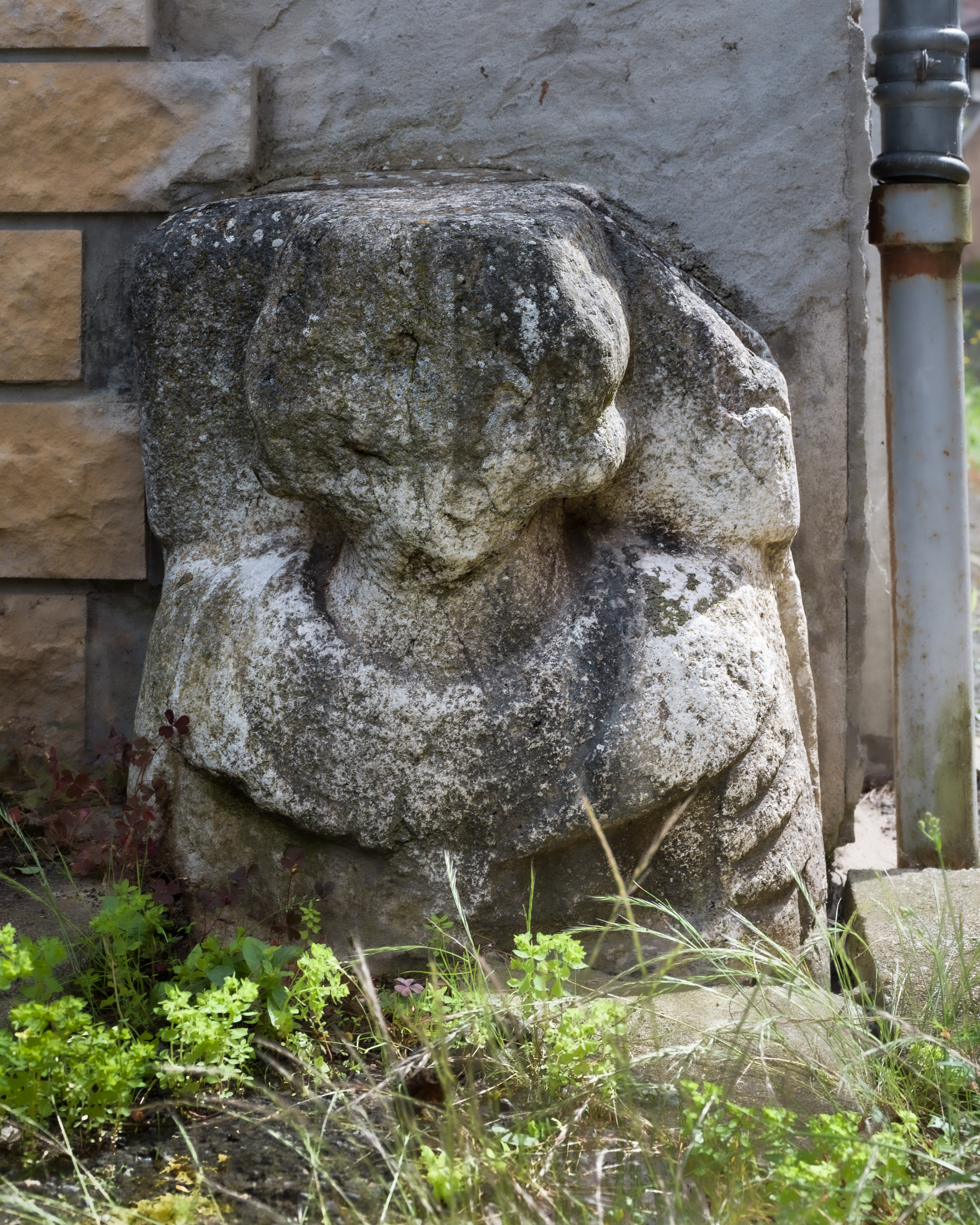
Peculiar effigies standing partially buried and framing the door of a former bakery. The figures are probably statues of Philippe de Vienne, Lord of Châteldon from 1436 to 1460, and his wife Pétronille de Chazeron. Both are buried in the church of the Cordeliers convent, which the couple built in the 15^(th) century. The convent and church were destroyed during the Revolution.
Maison Sergentale
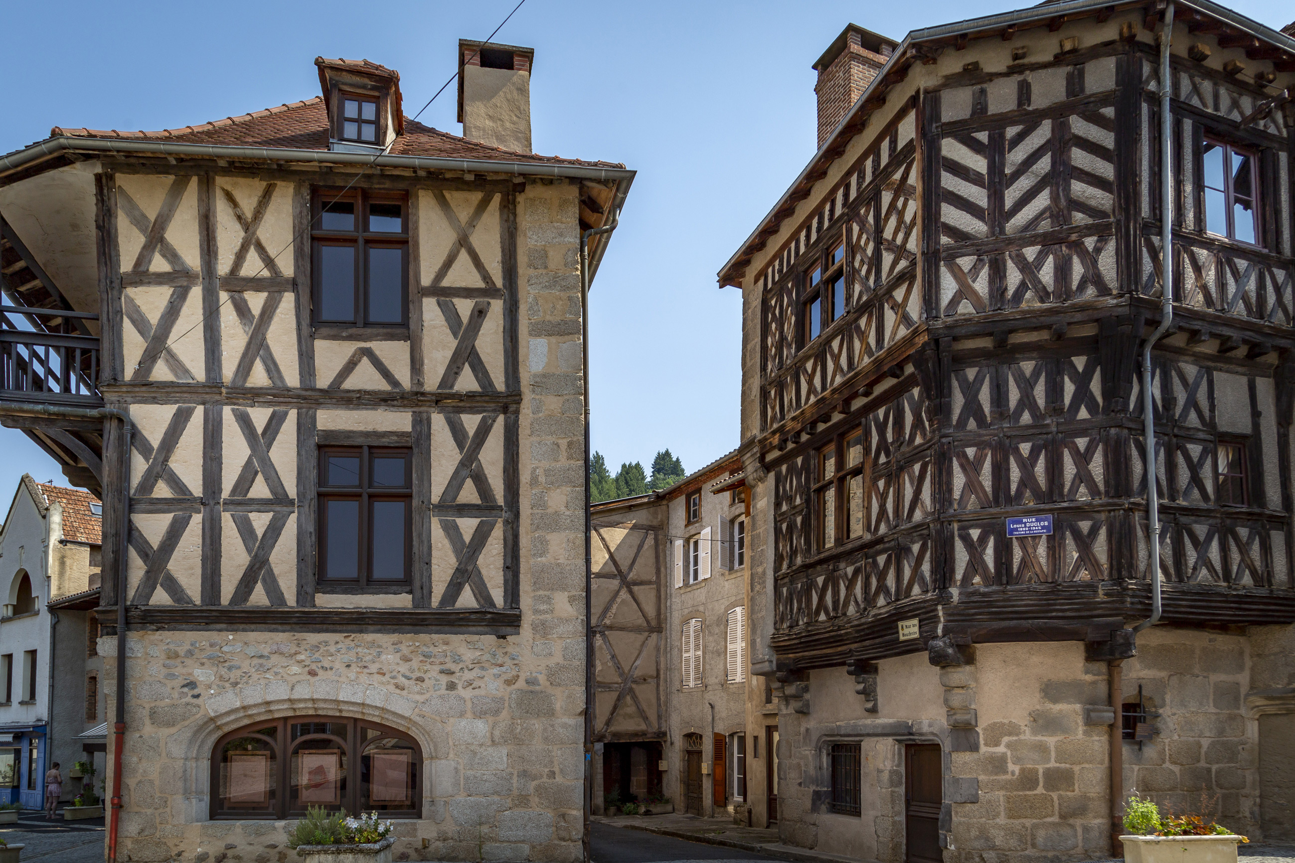
This magnificent half-timbered corner house, whose original name is unknown, was built in the 15^(th) century and is one of the oldest in Châteldon. On the ground floor, which is made of arkose sedimentary rock, a stall topped by a basket-handle shaped arch recalls the building's former use as a shop. The first-floor façade is divided into three sections featuring Saint Andrew's cross-shaped corbels. The second floor combines these with small posts arranged in a chevron pattern. The floors are connected by an external turret housing a spiral staircase with superb corbels.
Hôtel-Dieu
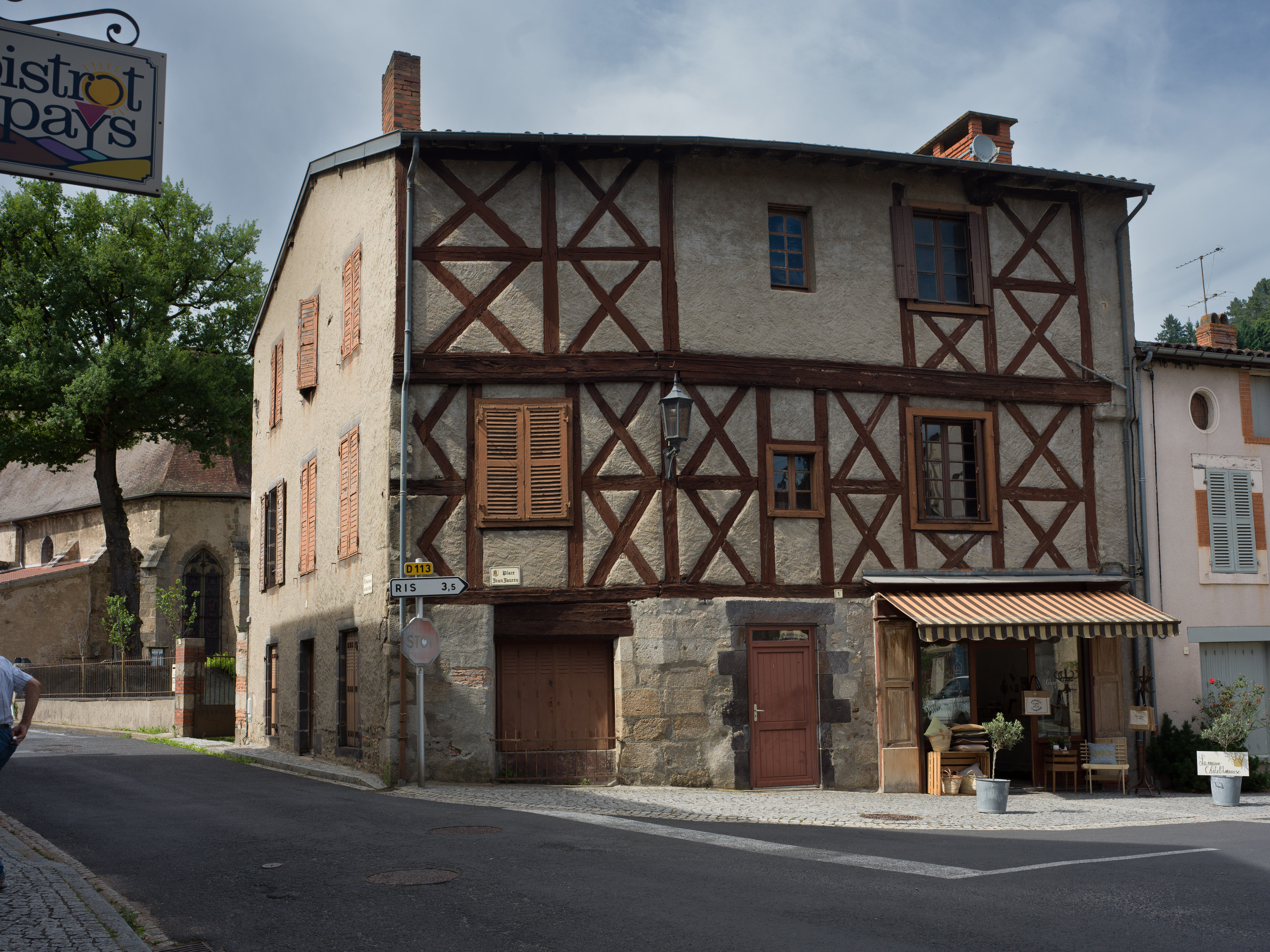
On the site of a former site housing lepers, the Count of Lude, Jean de Daillon, founded the Hôtel Dieu in the second half of the 16th century. It had up to eight beds and a chapel. Only the timbered façade remains today, as the rest was destroyed during the Revolution.
Old Pharmacy
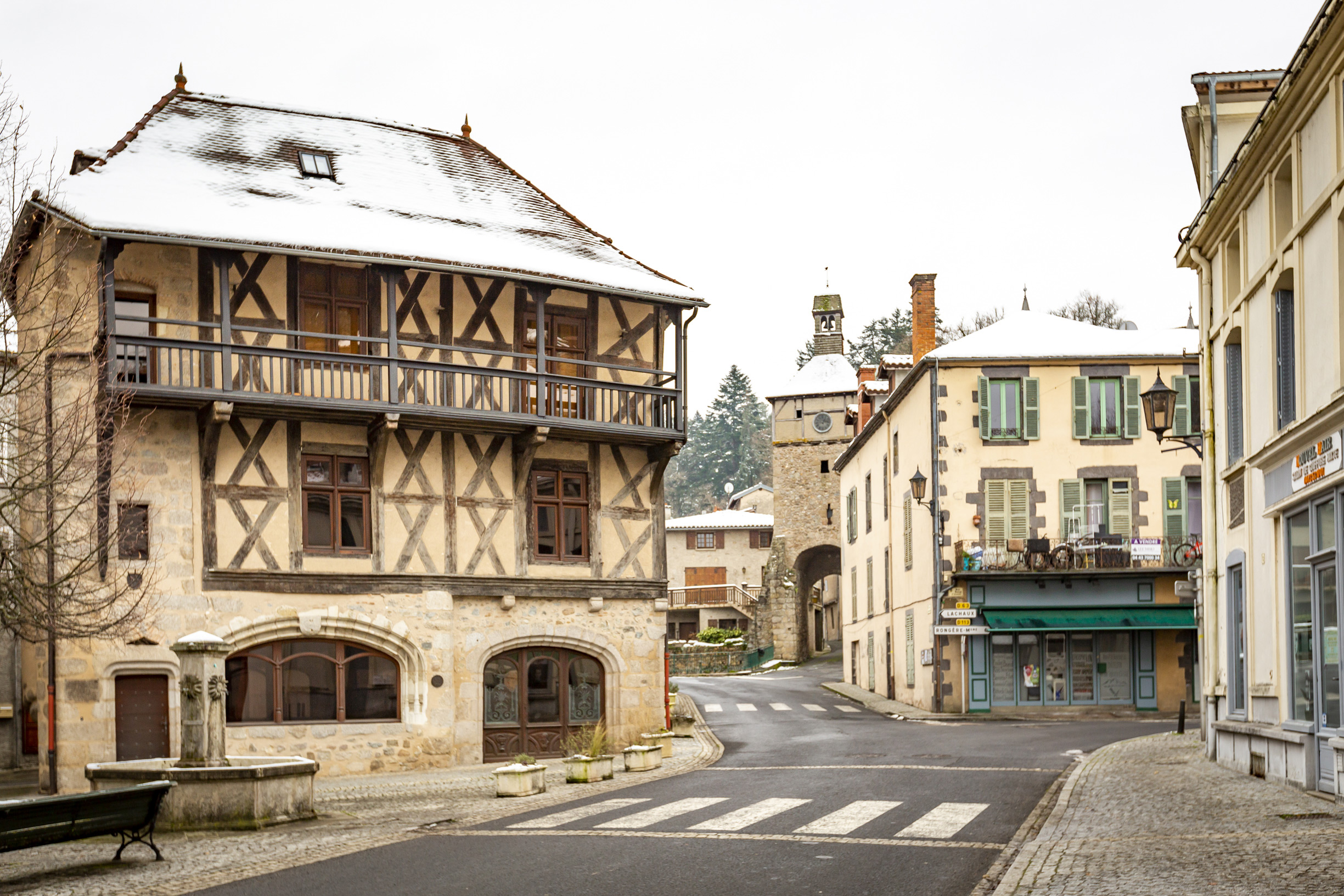
This timbered house with corbelled windows dates back to the late Middle Ages. It overlooks Place Jean-Jaurès and Rue des Boucheries with its two large, semi-circular arched windows. The ground floor is made of arkose, a sedimentary rock, and has basket-handle windows with stalls, recalling its former use as a shop. The bottom of the entrance door is adorned with a double caduceus, the symbol of pharmacies, framing the face of a former owner. The upper floor features St Andrew's crosses. The second-floor balcony rests on wooden corbels and is protected by a canopy extending from the roof. Today, this house hosts exhibitions and serves as an artists' residence.
Fountain on Place Jean Jaurès
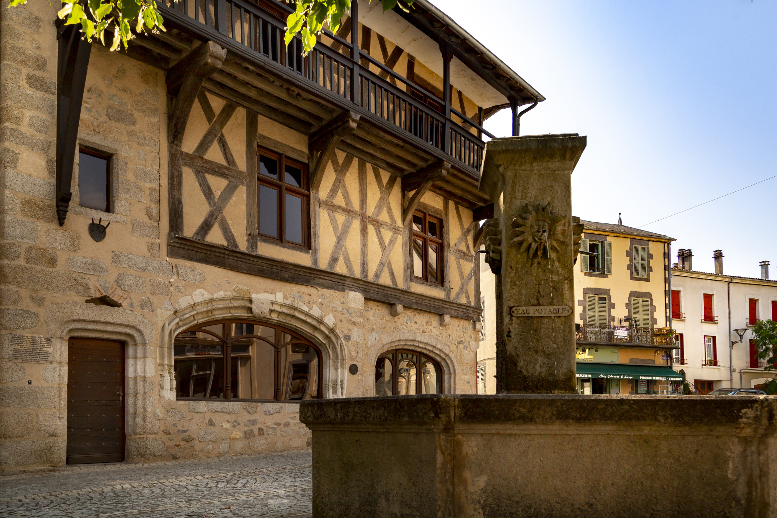
Standing in the centre of the square, it features an octagonal basin. The fountain consists of a square column topped with a pyramid at its summit. Each side is decorated with a human face enclosed in a sun-shaped sphere evoking King Louis XIV, also known as the Sun King, who was fond of the water from Châteldon.
Saint-Sulpice Church
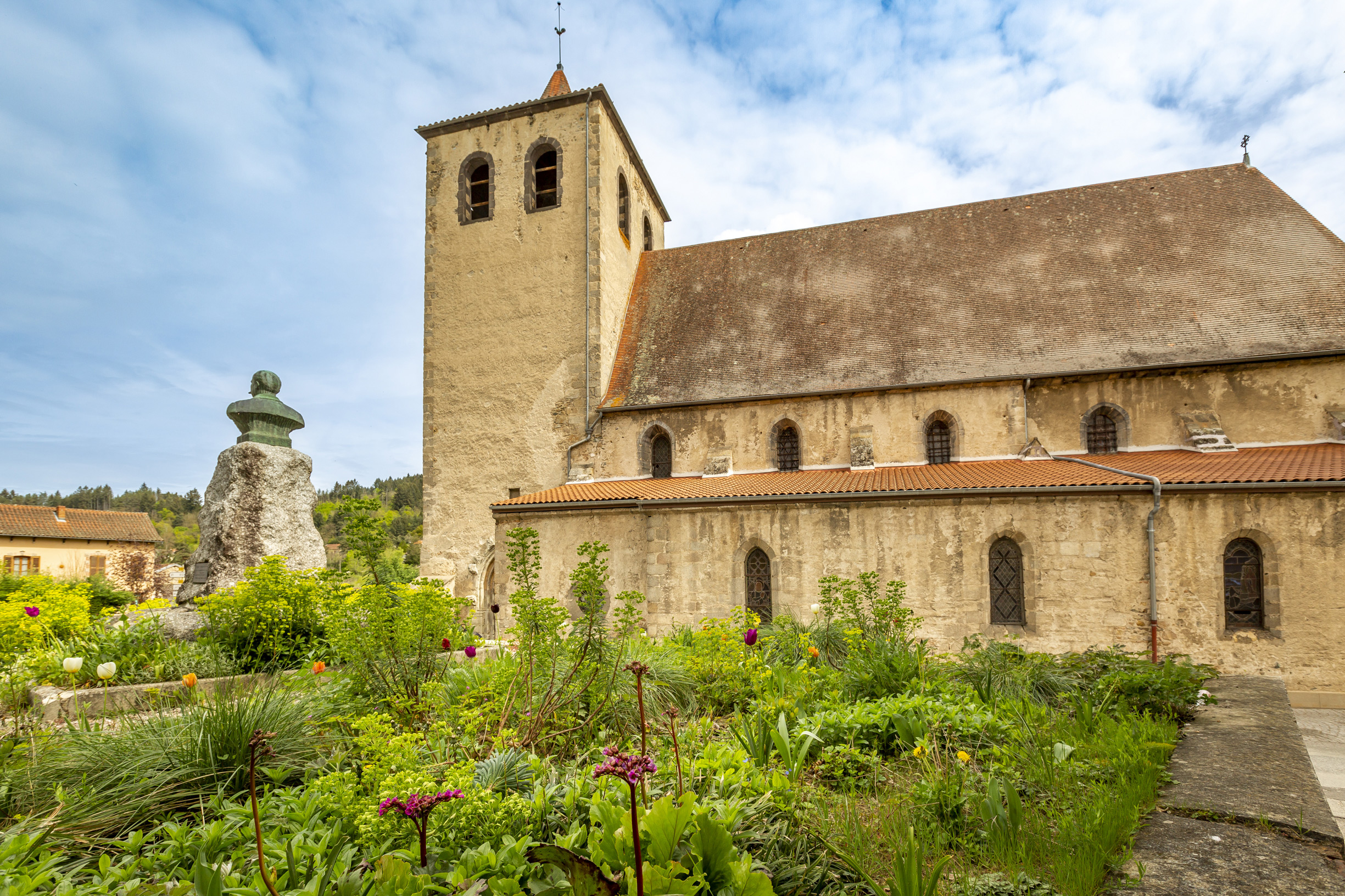
A 12th-century church, of which only one wall remains, was replaced by this Gothic-style building, constructed in 1430. According to a 1314 document, Isabelle de Montaigut is believed to have rebuilt or founded it, and to have had the ancient sanctuary rebuilt. Measuring 36 metres long and 19 metres wide, it is the most imposing religious building in the canton, with a bell tower rising 30 metres. The church formed part of the second enclosure; its original defensive role explains the absence of an opening to the west. It has a five-bay apse and nave with aisles serving side chapels, added in 1767 to enlarge it. Inside are a 13th-century wooden majestic Virgin and an 18th-century waxed wood Virgin and Child. The square bell tower, with a pavilion roof and lantern rebuilt several times, houses two bells, the oldest dating from 1736.

Ce projet de carte interactive est porté par les associations Petites Cités de Caractère® de France, Petites Cités de Caractère® en Auvergne Rhône Alpes, Petites Cités de Caractère® du Puy-de-Dôme et par la commune de Chateldon.
Il est soutenu financièrement par la convention FNADT du Commissariat Massif Central, par l'appel à projet « patrimoine et numérique » de la Région Auvergne Rhône- Alpes, et par la Fondation d’Entreprises du Crédit Agricole Centre France.
Le plan de la commune (visuel de fond) a été réalisé par Lemoineau.
Les traductions en anglais ont été réalisées par Kim Spychalski.
Les voix ont été produites et enregistrées par Marie Léger (version française), Tamara Souverain (version anglaise).
Les photos ont été produites et réalisées par Julie Baudin. Les photographies réalisées par Julie Baudin ont été subventionnées par le Conseil départemental du Puy-de-Dôme.
Les vidéos ont été produites et réalisées par Petites Cités de Caractère®.
Conception et développement de la carte interactive par Tabula Rasa.



Ce projet de carte interactive est porté par les associations Petites Cités de Caractère® de France, Petites Cités de Caractère® en Auvergne Rhône Alpes, Petites Cités de Caractère® du Puy-de-Dôme et par la commune de Chateldon.
Il est soutenu financièrement par la convention FNADT du Commissariat Massif Central, par l'appel à projet « patrimoine et numérique » de la Région Auvergne Rhône- Alpes, et par la Fondation d’Entreprises du Crédit Agricole Centre France.
Le plan de la commune (visuel de fond) a été réalisé par Lemoineau.
Les traductions en anglais ont été réalisées par Kim Spychalski.
Les voix ont été produites et enregistrées par Marie Léger (version française), Tamara Souverain (version anglaise).
Les photos ont été produites et réalisées par Julie Baudin. Les photographies réalisées par Julie Baudin ont été subventionnées par le Conseil départemental du Puy-de-Dôme.
Les vidéos ont été produites et réalisées par Petites Cités de Caractère®.
Conception et développement de la carte interactive par Tabula Rasa.